World of Wonders Project
Central America Expedition
![]()
|
|
|
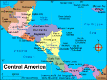
This is the second phase of the Around-the-World driving expedition of the World of Wonders Project. Come driving with our explorers through Central America. Travel with us as we traverse 2,810 miles (4,532 km) from Mexico through Belize, Guatemala, Honduras, Nicaragua and Costa Rica in a specially equipped, satellite-linked expedition vehicle. This Expedition was conducted from February 28 to April 12, 2005. Learn about the culture and visit with the people of these Central American countries. View the animal and bird life, climb volcanoes and explore colonial cities built by the Spanish. Swim in the second largest reef system in the world and wander the ruins of the Mayan civilizations. Follow the links below to start the expedition. |
|
|
Central America is comprised of seven countries: Belize, Guatemala, El Salvador, Honduras, Nicaragua, Costa Rica and Panama. It is an isthmus joining North America to South America, bordering Mexico on the north and Colombia on the south. It covers a total area of 202,000 square miles (523,000 square kilometers) and is about a quarter of the size of Mexico. Its narrowest point is only thirty miles wide (48 km) and is in Panama where the Panama Canal cuts through the land and links the Pacific Ocean to the Caribbean Sea.
The countries in Central America sit above gigantic tectonic plates that continually push against each other causing earthquakes and volcanic eruptions. A major earthquake occurs somewhere in Central America almost every year. In addition there are more than 20 active volcanoes in the region, with Tajumulco, a volcano in Guatemala, the highest at 13,864 feet (4,159 meters).
The overwhelming geographic feature of Central America is its long, unbroken chain of mountains running north to south. The mountains of northern Central America are an extension of the mountain system of western North America. The ranges of southern Central America are outliers of the Andes Mountains of South America. Rugged mountains also crisscross the region, making transportation, communication and economic development difficult.
While mountains and volcanoes dominate the Pacific side of Central America, the eastern Caribbean side rolls with ridges and valleys. This area extends in an east-west arc across northwestern Central America.
The area known as La Mosquitia is the largest remaining expanse of virgin tropical jungle in Central America covering the northeastern corner of Honduras and Nicaragua. (see below)
Although all of Central America is thought of as being tropical, its climate varies with altitude from tropical to cool. High up, the climate is cool, but down near the coast, there are steamy tropical jungles and the marshes of the Caribbean coast are especially hot and sticky.
Rainfall varies a great deal. Trade winds passing over the warm waters of the Caribbean Sea produce heavy showers throughout the year on the eastern side of the region but in the interior and on the Pacific side, the rainfall is less. Most of it occurs during the wet summer season between May and October. Hurricanes also batter the Caribbean coast periodically and cause flooding, mudslides and damage to roads and bridges.
What is the weather like in the Region today? Follow this link to The Weather Underground for the forecast for the cities visited by our explorers. Or check out this satellite map from Weather.com.
Try converting the temperature in your town from Fahrenheit to Celsius.
All of Central America is in the same time zone. What time is it in different cities in the region as compared to the time in your home town? Check this!
| Geography |
Country Specific History
|
Amerindian History It is widely held that ancestors of the Central American Indians migrated to the area from the north. The Maya Indians had become the region's dominant culture by around 400 BC. The Maya ranged from Southern Mexico through Belize, Guatemala, El Salvador and Honduras. The more southern countries were home to less developed Indian societies. In 1501 Rodrigo de Bastidas and Juan de la Cosa of Spain were the first Europeans to explore the Central American coast. The following year, Christopher Columbus sailed along the eastern shore from Honduras to Panama and claimed the land for Spain. Vasco Nunez de Balboa discovered that the Isthmus of Panama was the shortest distance between the Caribbean and the Pacific Ocean. Following these explorers were the Spanish conquistadors who invaded Central America and fought the Indians. In less than 50 years the Spanish had completed their conquest of Central America, killing or enslaving nearly the entire Native population. In 1808 Napoleon I of France invaded Spain and forced the Spanish king into exile. As a result Spain's grip on its colonies was weakened. On September 15, 1821 the Audiencia of Guatemala declared its independence removing all of Central America, except Panama, from Spanish control. Later that year Panama also broke away and became a province of Colombia. Panama would not become independent until 1903. In the mid 1800's Britain took formal possession of what is now Belize, making it a colony called British Honduras. Belize would remain a colony until it was granted independence in 1981. Over the next 150 years Central America tried numerous times to unify the countries into one nation. In 1822 Coast Rica, El Salvador, Guatemala, Honduras and Nicaragua became part of Mexico. The following year they severed ties and formed the United Provinces of Central America. This collapsed in 1838. In 1842 El Salvador, Honduras and Nicaragua tried again, this time creating the Central American Confederation. This collapsed in 1845. In 1921 El Salvador, Guatemala and Honduras united under the banner Central American Federation. It too collapsed within a year. The Central American countries would remain independent countries although they would form an organization to provide free trade among their members. Britain invaded part of Nicaragua in 1848 and in the early 1900's the United States would become militarily involved in Honduras and Nicaragua. In the 1980's the United States would invade Panama. For country specific history, follow the links to Belize, Guatemala, Honduras, Nicaragua, Costa Rica and Panama. |
|
Economy
The people of Central America are among the world's poorest. Much of the lands belongs to a rich few who grow "cash crops" such as coffee and bananas to be sold abroad. These two crops are the most important exports of all the Central American countries, earning them the nicknames "banana republics" or "coffee republics". When banana and coffee prices are high, the countries prosper, but when prices are low, hundreds of thousands of workers suffer. Poor subsistence farmers make up nearly three-quarters of all rural inhabitants in Central America. By growing corn, beans and squash, farmers are able to feed their families and depending on the area, farmers may also be able to grow grains, fruits, vegetables and meat products for the commercial market. In the 1950’s, 60’s and 70’s cotton, sugar and beef became major exports. But despite this growth, Central American nations accounted for only 0.2 percent of the world’s economic activity. This economic growth did result in improved roads and highways and Central America began to attract foreign investment by businesses and governments. However, economic downturns in the 1970’s occurred with the increase in the price of imported oil and at the same time, prices for Central American exports dropped. Civil wars, border disputes and political tensions made the economic situation worse. Today, manufactured goods make up between one-quarter and one–third of the exports and these goods include food processing, beverages, tobacco, textiles, shoes and clothing. Producing chemicals and pharmaceuticals, refining petroleum, making cement, and processing paper and wood products contribute another one-quarter. But a continuing coffee price slump has been disastrous for small-scale farmers and thousands of workers continue to migrate north in search of better wages. Tourism has proved profitable for Costa Rica and other Central American countries have tried to follow suit by improving their tourism infrastructure, but they have a long way to go. |
|
Ethnic Groups |
People
Central America is home to various African, Native American and European cultures, mostly sharing the Spanish language and the Catholic faith but also speaking English or Amerindian languages and practicing traditional beliefs. The largest surviving groups are the Mayan communities of Guatemala and Belize (the Maya also live in Chiapas and the Yucatan in Mexico.) In Honduras and Nicaragua are many non-Mayan groups, including the Tolupanes, Pech, Tawahka, Lenca Chorti and Miskito peoples. Nicaragua is also home to the Rama. El Salvador has small numbers of Izalco and Pancho, descended from the Pipil. Costa Rica has few native inhabitants, but they include Boruca, Cabecar, Guatuso and Terraba. In Panama there are significant groups of Guaymi, Choco and Kuna. Black people inhabit much of the Caribbean coast, and many are descended from Africans brought to the West Indies as slaves. Black Creoles (mixed British and African descent) account for most of Belize’s population. The Spanish brought many slaves to the region, especially to Panama, but most came from the Caribbean during the 19th century as laborers (not slaves) to work on banana plantations. The Garifuna people are descended from Caribbean islanders and slaves. The indigenous of Central America that have held on to their native traditions have done so with much difficulty. They continue to survive against an onslaught of television and cell phones. Their cultures add color and flavor to the region. The family is very important to Central American daily life and society. Family ties contribute to people’s identity and families - usually including grandparents, aunts, uncles and cousins – tend to be large and to live together under one roof. In the cities of Central American countries, most men and women dress in western style clothing. But in the countryside, more traditional ways of dressing endure. Many Mayan Guatemalans distinguish themselves with their clothing. Mayan women wear a long corte (skirt) and huipile (blouse) with rich and colorful embroidered designs. Mayan men may also be seen wearing traditional clothing. Designs and colors can have religious, symbolic or magical meanings. In El Salvador men wear hats made of woven palm leaves and women wear ankle length skirts and loose blouses. During festivals, Panama’s folklore is evident in its colorful pollera, (the national costume) and tembleques (hair ornaments) worn by women. Many food dishes in Central America are based on corn, as corn has a deep cultural meaning for these countries. The Maya believe that humans were created from ground corn and water. Others believe that Quetzalcoatl, a mythical hero, put a grain of corn on the lips of the first man and woman, enabling them to think and work. The most popular musical instrument in many parts of Central America is the marimba, a zylophone made of wood. Marimbas vary greatly in size, from smaller ones played by one or two players, up to instruments played by 6 or 8 players at once. The marimba appears in an ancient Mayan manuscript, where a Maya musician plays a type of marimba made from a log. Certain areas of Central America are also known for traditional music and on the Caribbean coast the music is Afro-Caribbean in spirit and rhythm. Calypso and reggae can also be heard. Cultural celebrations in Central America emphasize what makes various groups special, either through their lifestyle or their values. In Guatemala, for example, folkloric festivals have grown out of the legends from the past. All traditional fiestas include folk dancing, the forms of which date back hundreds of years. Some of these dances are rooted in traditions brought from Spain, others spring from Mayan tradition and still others have African roots. Some cultural festivals in Central America are important because they acknowledge what the rhythm of life is like in Central America. In El Salvador, for example, some fairs and festivals center on the seasons of farming. There is a Sugar Cane Fair, a Flower Fiesta and a Straw Festival. In Nicaragua during festival times, people look forward to seeing traditional dances and skits performed to music at certain times of the year. Roman Catholicism was introduced by Spain and is practiced by three-quarters of the people in Central America. In British-influenced Caribbean areas, Protestantism dominates. Other religious sects include Baptists, Mennonites, Mormons and Seventh-Day Adventists. The Garifuna of the region’s Caribbean coastal areas continue to practice their traditional African-based religion, emphasizing the worship of ancestral spirits, in addition to Christianity. Some Amerindians have blended the Catholic faith with their traditional beliefs by praying to Christian saints and ancient gods as well. Mayan beliefs and traditional ways have lasted for centuries, primarily in Guatemala. |
|
Environmental Problems
Despite recent economic growth, Central America is still one of the poorest regions in the world. This combined with skyrocketing population growth and unemployment contribute to environmental problems. Rural forests are cut down and burned for firewood and large tracts of land are cleared for agriculture. This leads to large-scale erosion and soil loss and leaves many areas open to flash floods and mudslides. In 1950 about 60% of Central America was covered by tropical forest. About half that remains forested today. Some 90% of El Salvador’s original forest is gone. To Central America’s credit, the region does have 250 national parks, nature reserves and other protected areas. These protect ecosystems and habitats, including tropical rain forest, cloud forests, jungle river systems, lagoons and coastal wildlife reserves. However, poverty that forces people to use cut-down forests for fuel and poachers who catch and sell rare animals for profit are a continuing threat. In addition, cash-strapped Central American governments often don’t have the money to combat these problems. Also, pollution from cars, industry and power generation is a major problem in urban areas. La Mosquitia is a huge swath of Caribbean coastline, lagoons, pine savanna and the largest remaining expanse of virgin tropical jungle in Central America , all covering the northeastern corner of Honduras . Reached only by plane, boat or foot, the Mosquitia has the feel of a separate country, cut off from the rest of Honduras and the world. Most of the inhabitants of the Mosquitia belong to an indigenous group, either Miskito, Tawahka, Pech or Garifuna. The Mosquitia “cultural zone” crosses the Rio Coco and into eastern Nicaragua with the areas inhabitants crossing back and forth constantly to visit family and work in both countries with little regard for border formalities. The rainforest of the Mosquitia faces pressure on its edges by land-hungry peasants, cattle ranchers and mahogany loggers who are chopping and burning the forest at a rapid rate. In an effort to slow the destruction, in 1980 the Honduran government created the Reserva de la Biosphera del Rio Platano, protecting 815,000 hectares of Primary jungle and savanna in the center of the Mosquitia. In 1999 two more reserves were created placing a huge region of the Mosquitia and neighboring Olancha under protection. |
| Flora and |
Flora
There are five major types of vegetation in Central America, all influenced by differing altitudes, climates and soils. On the Caribbean coast, tropical rain forest has canopies of tall trees and lush ground cover. The Pacific coastal strip and northern Belize is home to tropical dry forest, with trees and shrubs parched brown during the dry season. Higher up in altitude, the cooler climate is home to a mixed upland forest of evergreens, pines and deciduous oaks. Even higher up is the cloud forest. The extreme humidity helps tall trees from drying out, which protects the herb and moss covered floor from direct sunlight. Only a few areas above 3,000m in Central America have alpine vegetation, with short grasses and flowering herbs. Fauna Considering its small size (523,780 sq km, about the size of France) Central America’s flora and fauna are incredibly diverse. 7% of the world’s species can be found here. Animals that can be found in the jungle include: monkeys (spider, howler, squirrel), cats (jaguars, pumas, ocelots), sloth, deer, anteaters, bats and agouti. Even more impressive are the number of birds that live or migrate here. Over 900 species have been recorded in Panama alone. The many birds of the region include toucans, macaws, parrots, harpy eagles and hummingbirds. Many amphibians and reptiles include sea, river and land turtles, crocodiles, snakes, frogs and iguanas. On the down side, of the 11,046 plants and animals at risk of extinction in the world, 1,184 are in Central America and Mexico, where logging is shrinking habitats and wiping out species. Even Guatemala’s national bird, the quetzal is at high risk, along with other lesser-known regional creatures, including the Pacific pilot whale. |
|
Contact us for information regarding sponsorship opportunities.
Join the Virtual Classroom. Complete the free registration form for your classroom today. Support the expeditions. Your donation will help to continue the research, documentation and Virtual Classroom web site presentation of these wonderful cultures and experiences to the broadest possible audience. To find out how you can help, please follow this link to our Helping Hand page. Thank you, now it's time to explore! |
|
ALF Home Central America Home Journal |
*Sources: Central America: Facts and Figures by Charles J. Shields, Honduras published by Moon Publications, Central America on a Shoestring published by Lonely Planet
Kim and Don Greene, Contributors; publication date February 2005