April 26th
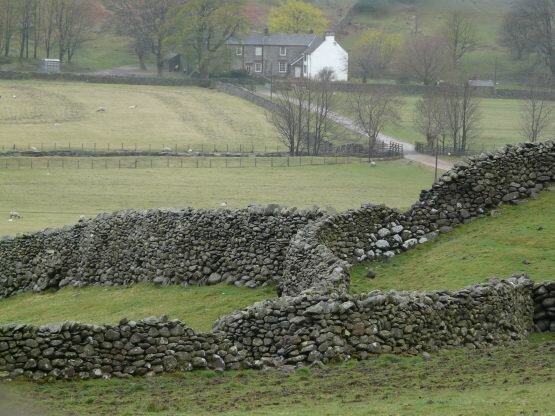
From our campsite we had fabulous views along the valleys to where the hills blended into the clouds. Great Langdale is known for all the hikes that can be undertaken, up crags to cloud enshrouded peaks, to waterfalls, lakes and fells. We chose to start our day with a bike ride back down the valley so that we could enjoy the views and villages that we had driven through yesterday when we were so busy concentrating on the narrow roadways.
|
|
|
We had contemplated doing a loop ride of about 16 miles, but during the riding up and down and up and down, we realized that the loop wasn’t really possible, so we contented ourselves with a nice 8 mile ride. After we returned and relaxed for a few hours, we decided to hike up to the end of the valley to where we had views of a small waterfall. We ended the day rather exhausted, but happy.
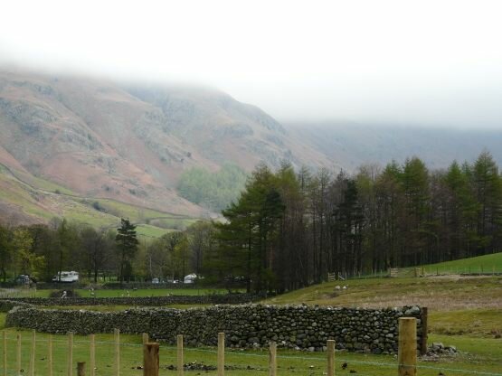
We thought it would be nice to visit another area of the Lake District and decided on a lesser visited area along the Borrowdale Valley. We talked with the Ranger at our campsite before departing, and he assured us that we wouldn’t have any problems visiting Borrowdale and then continuing over a pass to the little village of Buttermere.
The sights along the drive were really nice, but when we arrived at the base of Hollister Pass, we were greeted with a sign that indicated that vehicles wider than 6’6” could not continue - we are 8’2” wide! Luckily there was a parking lot right there and in the lot was another ranger. Now this ranger said that there was no way that we could get beyond the pass and he couldn’t believe that another ranger had given us bad information.
|
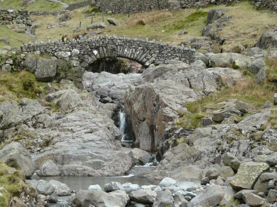
Looking on the bright side, there happened to be a small campsite run by a farmer just a short distance away, so we picked this as our destination and set up camp. Not knowing what was around, we set out walking up a different valley. The road we walked on ended at another farm, but we were able to continue on a footpath for another mile or so, climbing up the valley until it ended at an old bridge that crossed a small waterfall, and the sun came out for a while (before it rained again). |
|
|
|
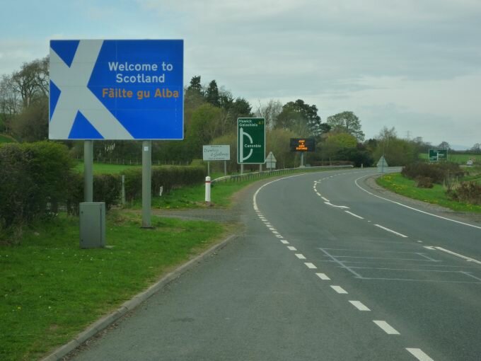
In the morning we retraced our drive out of the Lake District and headed north again arriving in Scotland in the afternoon. We followed a sign for a picnic area up a narrow one lane road that lead us to the end of a commercial forest. The area was quiet, we were along a small brook and had lots of bird sounds. As we drive further north, daylight is continuing until about 9 pm. |
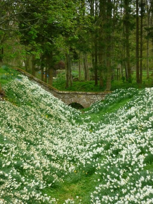
One really nice thing that we’ll remember are the daffodils. Being spring time, the daffies are in bloom everywhere. There are literally fields of bright yellow, white, or combinations of colors brightening up the day. They’ve been beautiful.
We set up a nice loop through the Borders region to visit several of the impressive abbeys that were left in ruins as a result of the battles fought for Scottish independence from England during the 1300’s and 1400’s.
|
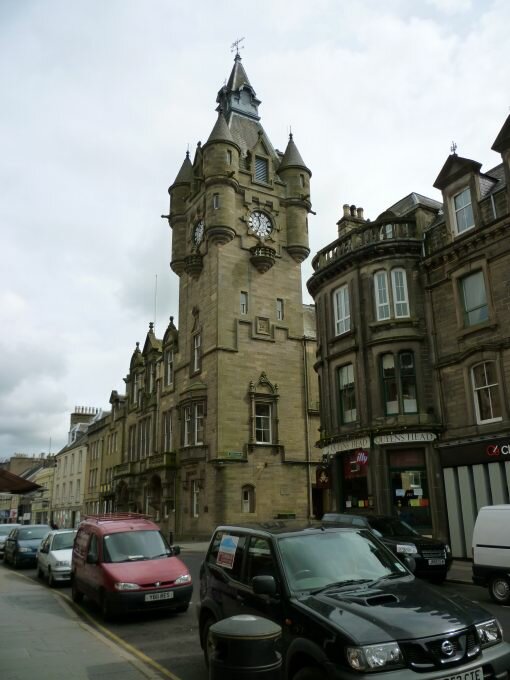
We started our journey at the Information office in Hawick where we collected tons of brochures and maps to help us find our way not just around Borders, but through the country. Hawick had a great clock tower that looked like it belonged to some castle or chateau. |
|
We found our way to the first abbey, at Jedburgh, and found a pleasant surprise – free wifi in the town carpark. So after exploring the ruins, from outside the walled enclosure – the entry was closed for unknown reasons, we were able to spend a few minutes downloading our emails.
|
|
|
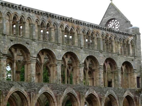
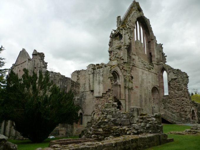
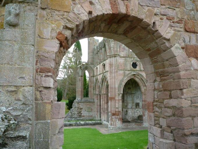
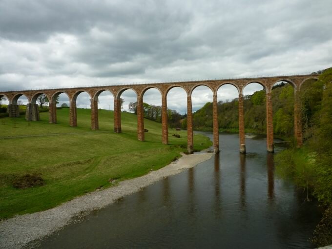
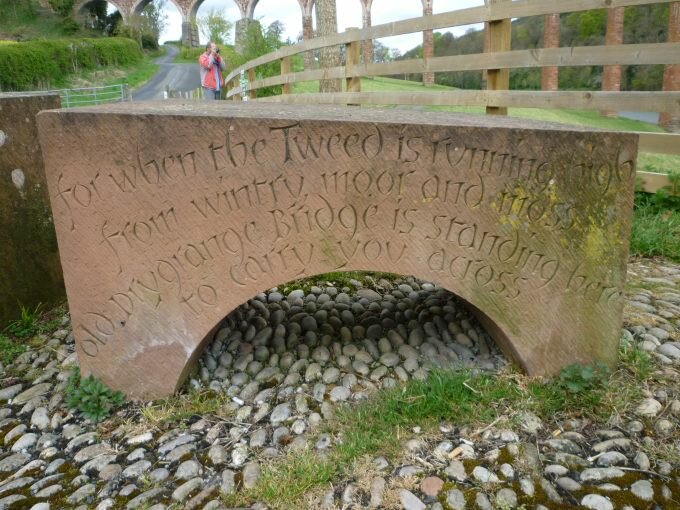
Finding our way to the next ruins of Dryburgh Abbey proved more challenging. The ruins are located on a bend of a river and our maps showed their location to be near a picnic area. We did find the picnic area, down a very narrow one lane road that ended at a pedestrian only suspension bridge. After crossing the bridge we could find no sign of the ruins, so we turned around and followed the signage around to a vehicle bridge, across the river and along a loop that pretty much took us to the other side of the pedestrian bridge where, about a mile further on, we found the ruins.
|
|
|
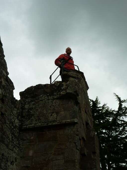
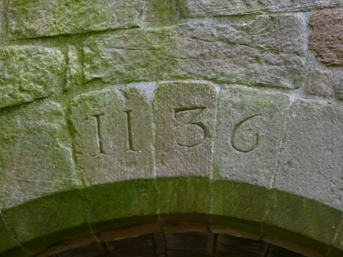
The ruins were very cool and the cemetery was interesting – we found a couple of headstones from the 1700’s and an arch with a date of 1136! It turns out that the ruins were bought by a local baron during the 1700’s who partially restored the buildings and who turned one of the church towers into his family crypt. I (Don) climbed up on of the spiral stone staircases that lead to the top of a tower. The view was great, but then I had to turn around on these tiny little steps and get back down without my feet slipping off. I’m not sure the view was worth the nervous effort to get back down the stairs!
|
|
|
While we were wandering around, several Royal Air Force jets went screaming by, then made several more passes while flying only a few hundred feet above the ground. We tried to get a photo of the jets over the ruins but they just flew by too fast.
|
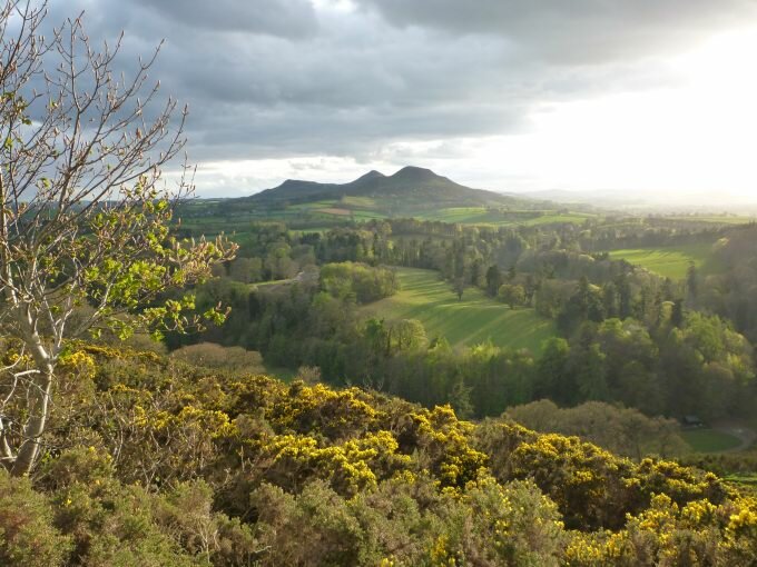
We drove up to a viewpoint called Scott’s View, named after Sir Walter Scott a local passionate Scotsman, historian, collector and writer. It was a magnificent spot overlooking several towns and a series of smaller hills. When the sun came out, about 8pm, the light was perfect. Needless to say, we decided that this would make a great night spot. |
|
|
|
|
Although we were only about 30 miles south of Edinburgh, we decided to postpone visiting the city until we return on our southern route. So we crossed towards Glasgow setting our next destination at the Unesco World Heritage Site of New Lanark.
|
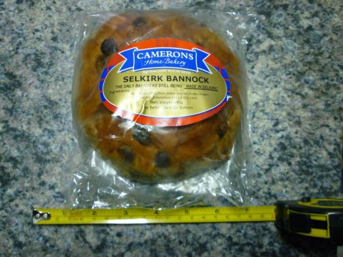
Along the way we detoured to the small town of Selkirk to try their world renowned Bannock. What, you ask, is a bannock? Our guidebook describes it as a plain, unassuming snack, a flat oatmeal griddle cake. It sounded something like a fancy pancake to us, but we thought we’d try it just the same. It turned out to be nothing like a pancake at all. It was more like a giant sweet roll with nearly more raisins than roll. It was tasty, it was sweet, we bought two. |
|
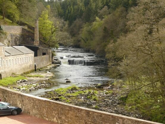
Back to New Lanark. We found our way to the parking area, but couldn’t see anything of the community. Following the path, we found the Site at the bottom of a river valley. What makes this site unique is that it is basically a preserved 18th century cotton milling village where the manager did away with the bleakness of mill towns and established a village where health care, education and a decent standard of living were established.
|
|
|
|
Another interesting thing is the location. The river valley is now part of the Scottish Heritage Trust and the valley is so clean that otters live in the river and falcons nest in the cliffs. |
|
After spending the night as the only ones in the parking area, we headed to Glasgow, hoping to do some sight seeing and work on the internet. What we found was a bit of a nightmare. Unfortunately we arrived in town on the Sunday of a three day holiday. The city was crowded, the parking lots were full and we couldn’t get a wifi signal in the places that we were able to park in. Feeling more than a little overwhelmed with the city, we decided to continue north to our first big loch at Balloch along Loch Lomond.
That night we walked around the little town and found a pub with live music to hang at for a little while. We got our first experience with Scottish hospitality there. When some of the people at the pub found out we were Americans, they welcomed us into their conversations, welcomed us to their country and offered us suggestions on where we should visit. It was a lot of fun.
|
|
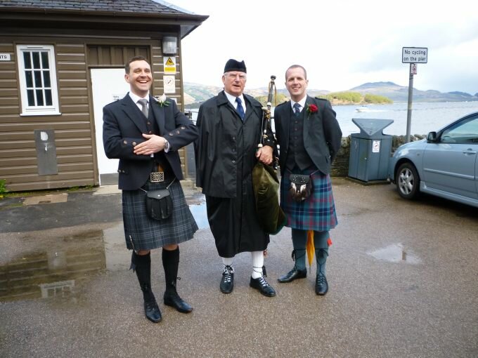
In the morning we drove up one side of the loch, following directions to a fun bike ride in a park nearby. When we reached the park, we found that the bike ride really wasn’t possible on the trails and that we’d have to share the one-land road with all of the holiday drivers. Ah, no. So we drove back around the loch the way we had come. We stopped off at a small village known for their cottages and gardens, Luss. It was a nice stop off, but was most interesting was the wedding that we came upon on the shore of the loch. All the men were in kilts and there was a bagpiper. Oh yes, very Scottish. We even got some of the men to pose for us tourists. |
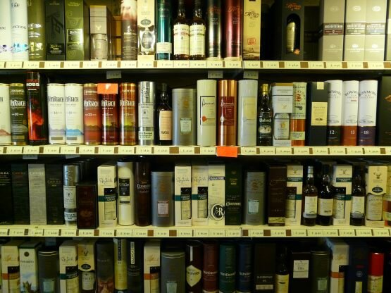
As we continued towards the western coast, we crossed over an early 19th century bridge and spotted a castle that reminded us of the Chateaus that we had seen in France. This was the Inveraray Castle, home to the Duke and Duchess of Argyll. Not only do they still live in the castle (it was built in 1789) but they have restored the traditional black and white coloring on nearly all the buildings in the region. We were also able to visit a shop selling Scotch whiskey, they had bottles for sale from every distillery in the country – and we got our first taste of authentic Scotch whiskey. The weather was not at its best during the day, it rained quite a lot, but the advantage was that in the hills we drove past lots of waterfalls created by the runoff.
|
|
|
May 3rd
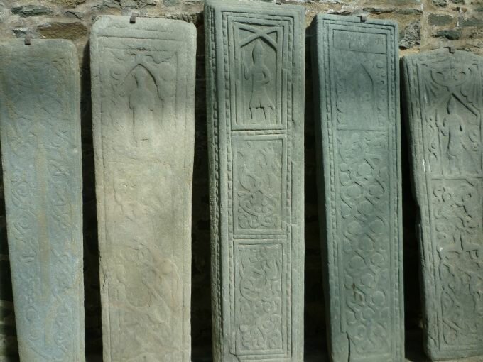
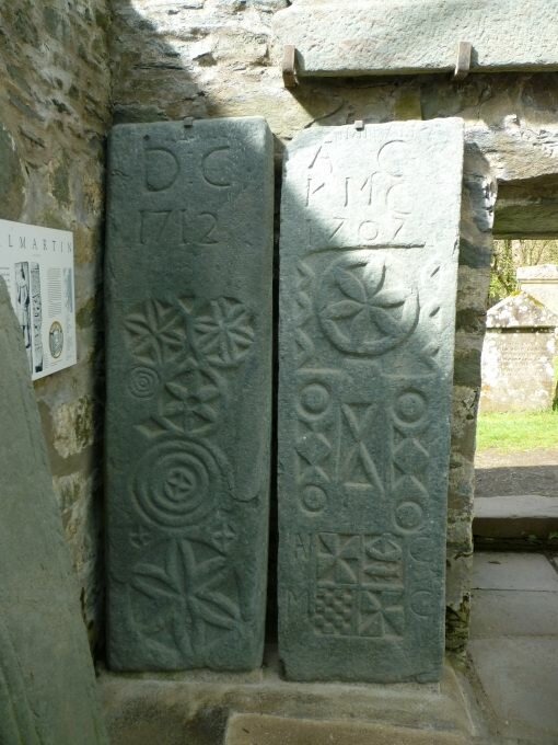
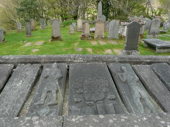
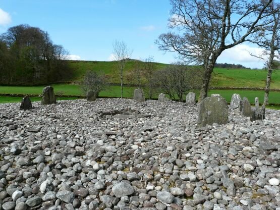
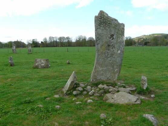
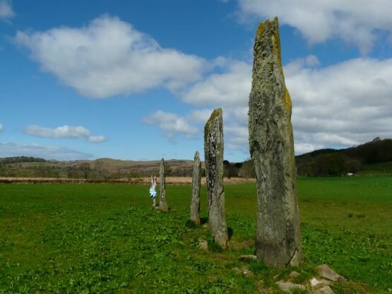
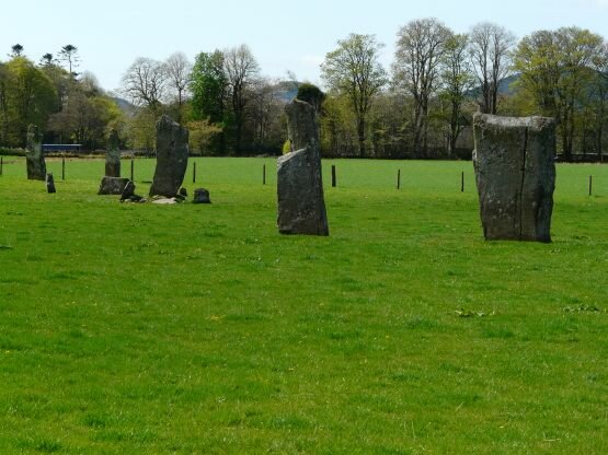
We spent most of today in or near the village of Kilmartin. As far back as 5,000 years ago, the people who lived around here built hundreds of monuments. There are stone circles, rock burial cairns, rock carvings consisting of “cup and ring” markings and ancient forts. On top of these, the church in the village was built in the 16th century and has the oldest tombstones and carved tomb coverings that we have ever seen. There were so many things to explore it was easy to spend the day hiking from one site to the next.
|
|
|
|
|
|
|
|
|
|
|
|
At the end of the day, we continued on to the city of Oban on the coast where we hoped to get fresh seafood. Our timing was a little off and all the seafood places were closed. So we found a nice parking spot along the water to spend the night. We’ll try again in the morning.
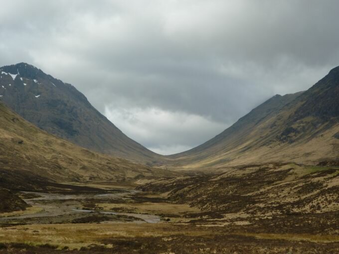
Making our usual coffee walk, we found a small restaurant open for breakfast and decide to treat ourselves. We both got a fabulous breakfast sandwich overflowing with scrambled eggs, potatoes and bacon, yum! By now the seafood mongers were open again, so we bought some fresh mussels, clams and smoked salmon for later on. Life is good. We then drove into the Highlands and camped in the campground in Glen Coe, NP.
|
|
|
|
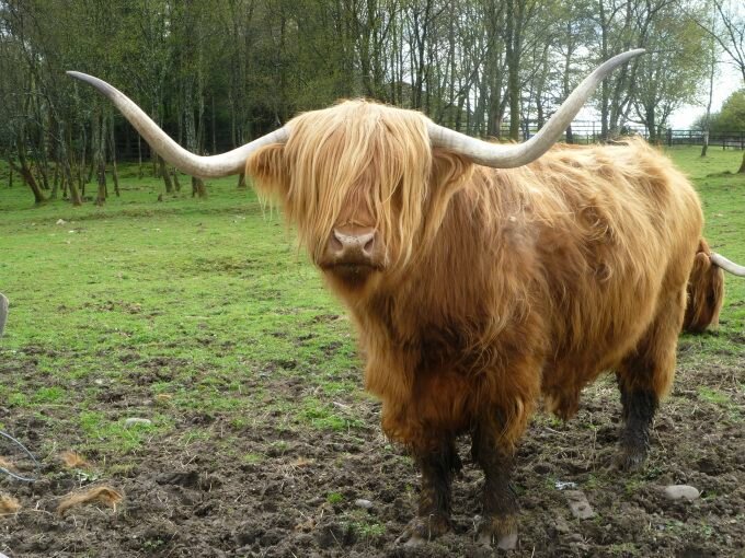
The next morning we drove up the road into the glen and marveled at the mountains (with snow), waterfalls, glacial valleys and greenery. We stopped several times to take photos and hike around. We only drove to the top of the glen since we were actually heading in the wrong direction from the way we wanted to go, but going back was just as good and you could see the things you missed on the way up. We also got some good sightings of Highland cattle. |
|
|
Home UK Journal |