|
Oct 5, 2007
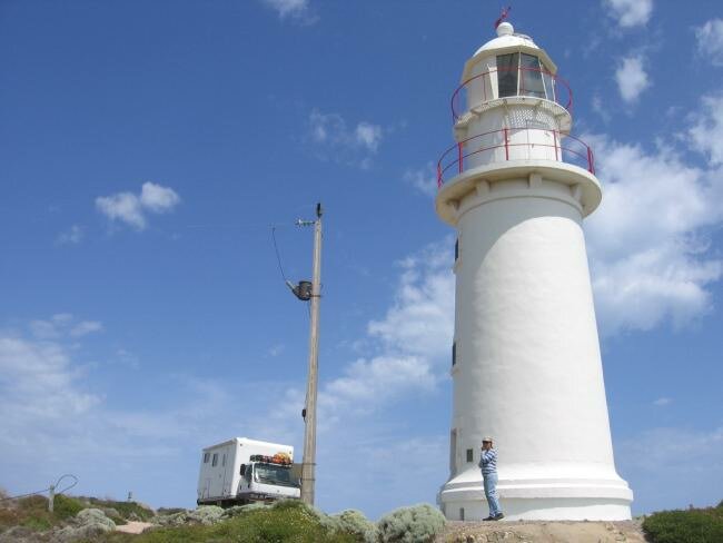
| On the advice of the locals that we met in Port Hughes, we drove south to Point Dunn at the bottom of the Yorke Peninsula. Along the way we drove through lots of fields of wheat and barley, the local economic powerhouse - which was a big change from the red sand desert up north. After visiting the Corny Point lighthouse, we set up camp on a great point across from the lighthouse. After a couple of hours of beautiful weather, the wind picked up and was rocking the Fuso so badly that we had to move to another more protected spot up the beach a couple of km. But before we left we were able to watch dolphins surfing the waves. |

|
Oct 6
The wind died down a bit during the night and was still calmer in the morning so we decided to spend the day relaxing. Of course a day off seems to always include a bit of maintenance but we had time for long walks along the beach, climbing over slabs of rocks that were being eroded from beneath, causing them to tumble onto the sand. We even found a few layers in the rocks that held shell fossils.
Oct 7
The next day we drove across the peninsula to the east coast, stopping in Edithburg to watch the activities along the pier. We then drove a bit further south of town to the end of the road at Wattle Point where we walked along the beach to a wind farm. There were about 30 turbines spinning, providing green electrical power to the region. We then we drove north along the Gulf of St. Vincent looking for a beachfront bush camp. Our guidebook had stated that there were many roads to secluded beaches, so we went looking for one. Hah, every beach we found was full of vacation homes with "No Camping" signs up. We did finally find an unnamed road that took us down to what is probably the last undeveloped spot on the coast. We enjoyed the quiet.
Oct 8
In the morning we walked along the beach and explored as the tide was going out. We saw several people wading into the water holding rakes and pulling inner tubes and plastic boxes behind them. They were out trying to catch swimming crabs, but from where we watched, it didn't appear that they were having any success. Finally hitting the road, w stopped for a traditional lunch of Cornish pastries. The pastries were served hot and were filled with potato, carrot and a tiny bit of meat, quite tasty.
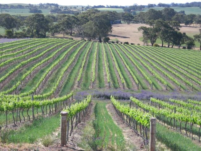
We then picked a route to the Clare Valley, home of one of Australia's best known wine regions, famous for their Riesling wines. We visited one winery and spent quite a while talking with one of the owners. In a earlier "life" he was a sheep shearer, much more difficult work than making wine. We spent the night in a parking lot smack in the middle of town where absolutely no one bothered us.
Oct 9
| In the morning we walked around town, did laundry, ran a couple of errands and then drove along several of the wine routes visiting wineries and talking with the wine makers. We were eventually able to find a place to park our Fuso, and take our bikes out for a ride along their Riesling Trail, a bike path along an old railway line that wound through the valley. Along the way we stopped at more wineries and enjoyed learning about winemaking the the region. It was a beautiful ride. |

|
Oct 10
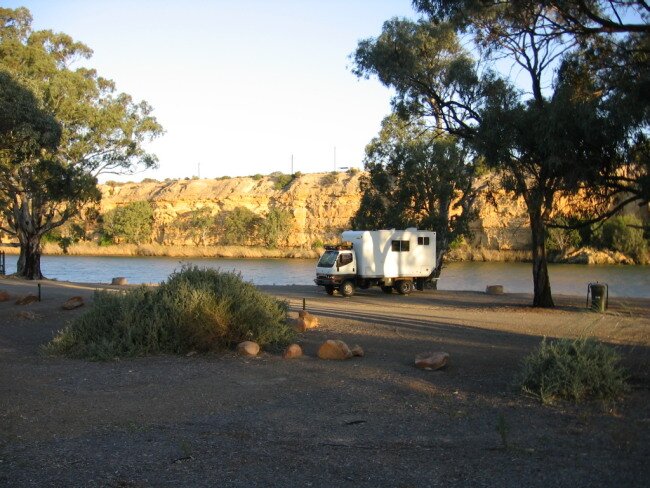
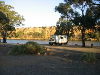
| We decided to drive along the River Murray so we headed east to the small community of Swan Reach and found a great free camp spot next to the ferry crossing, across the river from town. The road crosses the river several times and many of the towns are served by free ferries as it is still more cost efficient to operate the ferries rather than built lots of bridges. |
|
Oct 11
The weather has changed and we are now getting some small rain squalls. We were hoping to launch our kayak for a day on the Murray, but it's too windy and cold, so we drove to Big Bend. Big Bend is where the river takes a huge turn, carving out the tallest cliffs along its course. The cliffs were filled with birds - cockatoos and corellas. There was also a big midden full of shells and animal bones. Middens are basically ancient garbage pits, but are of great value to archaeologists and have cultural value for the local Aboriginals.
We spent the day along the River Murray, exploring one of the 26 locks built to facilitate river boat traffic 80 years ago. Now that there is little commercial river traffic, the locks are used mainly by recreational houseboat users. The Australian government is currently modifying all of the locks and weirs (small dams) to add fish ladders so that the native fish can reach their traditional spawning grounds, hopefully causing the fish populations to increase.
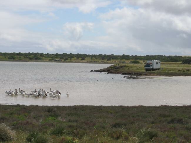
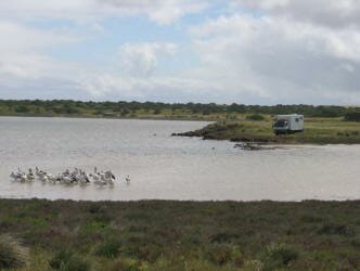
We stopped off at the Banrock Station Winery and wetlands. Unfortunately the wetlands were dry, the owners of the land decided to allow the wetland to return to its natural state - which means that there will be occasional times of dry. This is the first time in 65 years that the wetlands will have dried out. It is expected that when the rains come, the river will rise and the wetlands will fill again. In the meantime, the water that would have been pumped into the wetlands will remain in the river during years of drought.
Oct 12
|
This morning we reviewed our choices, continue east along the River Murray into the state of Victoria, or head south to the South Australian coast? The coast route won out, so we drove south toward the mouth of the Murray in the Cooronga National Park. If the wind drops a bit, we might be able to inflate our kayak and paddle out towards the actual mouth, the place where the river enters the ocean.
We made camp in a great location on a point within view of the large sand dunes that are on the Younghusband Peninsula across the lagoon from us. We spent the night rockin' and rollin' in the wind.
|
|
|