|
Oct 27
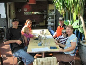
| Getting up early from our industrial park campsite, we headed back into Melbourne for an early breakfast with our friends from Maxtrax. We then visited the Queen Victoria market, the Melbourne Gaol (Jail) and the Exhibition Hall. We ended our Melbourne visit with a trip to a Japanese restaurant for lunch where we had grilled octopus and baked mussels covered with a cream and cheese sauce, yum. |
|
We then finally headed out of Melbourne towards Wilson's Promontory finishing the day in the village of Fish Creek. Staying in Fish Creek was unintended, but we stopped at the public restrooms on the highway and happened to look down into the park below. Driving around to see what was there, we discovered a camping sign on a small patch of grass, next to the old train terminal and along the "rails to trails" line that runs through Victoria. We spent a lovely evening, BBQing and enjoying the quiet.
Oct 28
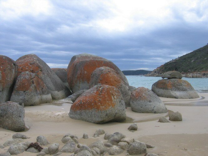
After a walk down the trail, we headed to our destination Wilson's Promontory (Prom), which is a piece of land that juts out into the Southern Ocean. This was once an island, but sand silted up the channel with the mainland. With ocean on three sides, there are lots of opportunities to walk on beaches and explore. Our first stop was Darby Creek where we hiked along the creek to the ocean and then watched the surfers catching waves.
| Our next stop was Whiskey Beach where we had lunch and once again hiked to the ocean. This was a particularly beautiful beach with granite outcroppings on either end. On the south end there was a trail up and over the rocks to a viewpoint out to sea and to the next beach down the way, Picnic Beach. |

|
We then made our way to the one and only campground on the Prom, the Tidal River campground with its 450 sites! Fortunately, it not being a school holiday, the campground wasn't crowded and we found a nice site. While we were registering at the Visitor's Center, the rain that had been threatening all day, finally decided to come down. And down it did, the most rain that we have seen at any time the entire time we've been in Australia. The weather forecast also called for gale force winds, but fortunately there were no sign of them.
After waiting out the rain, we headed out for a hike in the wetlands. The campground is situated in a very interesting location, with a tidal river running along one side and the ocean on another side. A trail has been constructed running alongside the river from the ocean, inland, with a boardwalk protecting the fragile wetland area that exists there. We very much enjoyed our hike.
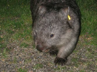
| At dusk, we grabbed our umbrellas, and went out walking through the campground in search of wombats. This is the one animal in Australia that is legendary and we have yet to see. After walking for about 10 minutes, we sighted our first wombat! It was unconcernedly munching on the grass at the edge of a parking lot and we were able to get very close to him (her?). Not surprisingly, the animals in the campground are habituated to humans so they are unafraid which is nice for photos, but is unnatural behavior for wild animals. We watched him until he wandered off into the bushes and then spied a second wombat across the parking lot. It disappeared before we could reach it however, so we started heading back to our campsite just as it started sprinkling. But along the way we spied another wombat. This one wasn't quite as habituated and wouldn't let us take his picture, but he was interesting to watch just the same. But because we had stopped, we ended up getting caught in a downpour and hiding out in an amenities (restroom) building for about 15 minutes before we could return to the Fuso. |
|
Oct 29
|

|
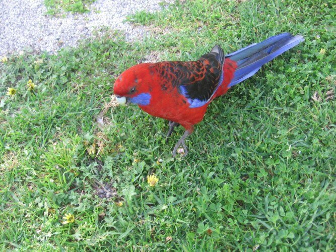
The next morning we went for a hike down the river and across the beach. It was amazing to see how much the river had swelled due to the previous night's rain. After returning for breakfast, we decided to pack a lunch and do a hike from the campground across to another trail through an area of warm temperate rain forest. Considering that the Prom contains Australia's most southern point, it is amazing to think that there is rain forest there, but that is the amazing thing about Australia. Along the way, we spied three new birds. All through the campground are beautiful, bright colored Crimson Rosellas. Apparently people feed them as they are quite aggressive as they landed right on us! |
In the evening, we once again went out in search of wombats. This time it was more difficult to find one, but once we did, he stayed in the same location for quite a while and we got a good chance to watch him.
Oct 30
| Once again in the morning we hiked down the river to the ocean and enjoyed its beauty for the last time before leaving. We then headed out and up to the highest viewpoint in the park, Mt. Oberon. This would also be the furthest spot south that we would drive in continental Australia. We then headed back down to Cotter's Beach where you can walk along the shore and explore the flotsam and jetsam that get washed up on the long beach. It was then time to leave the Prom and head north. We found a nice spot to camp in a state forest. |
|
Oct 31
|
|
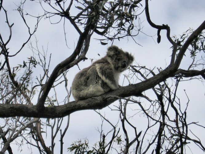
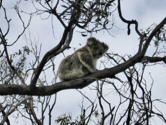
In the morning after doing a hike around our forest campsite, we headed off toward Paynesville and the Lakes District of Gippsland. In Paynesville we unloaded our bicycles, got on the ferry and took the five minute ride across to Raymond Island. There we followed the paved and unpaved tracks looking for birds and koalas. Surprisingly, we didn't see any new birds, but we did see quite a few koalas resting in the tree tops. |
|
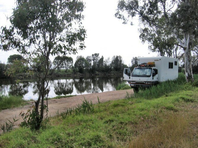
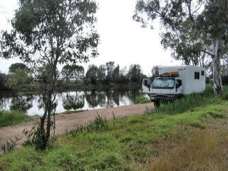
Heading back across on the ferry, we debated about city camping or trying to find a more secluded spot. Don remembered seeing a possible spot, so we headed back along the road heading toward Jones Bay and found a free campsite right along a river! We don't know what this area used to be, but it was along a paved road that dead ended at a bike lane and ran directly along the river There were turnouts and tables and the site we picked had a small dock. There was one other motorhome that had found this lovely spot and we spent a quiet evening watching the birds on the water.
|
|
Nov 1
In the morning we once again got our bikes down and rode down the bike path. After a couple of kilometers along the water, the trail abruptly ended at a landslide. This area got heavy rain back in August and this was one of the areas that was damaged. There was heavy equipment working to shore up the hillside, but it ended our bicycling early. We then headed into Bairnsdale and ran some errands. After lunch we headed north onto the Great Alpine Road toward Snowy River National Park. The drive was beautiful as we were finally in the mountainous area of Australia and it was a beautiful change of scenery for us. We ended our day at the Little River Gorge, camped in the parking lot for the gorge hike. The road was closed beyond this point (more storm damage) and we knew it would be a quiet evening. We had our first campfire in ages as the temperature, fire rings and availability of wood all created the perfect excuse to have one.
Nov 2
In the morning we hiked to the gorge overlook. This 500m deep gorge is the deepest in Victoria and had an incredible view. On the hike back to the campground we got a very brief view of a Superb Lyrebird (as it ran across the path, quite a ways ahead of us), which if we had gotten a good view of it would really have been superb!
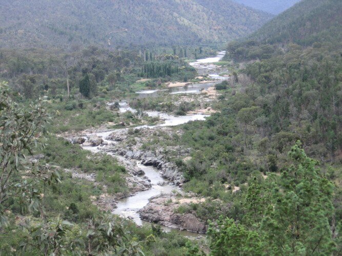
We drove back out to the main road and headed north on the little used dirt road that heads into Kosciuszko National Park. For the rest of the day we oohed and ahhed at the gorgeous scenery along the Snowy River. But the scenery was flawed. In December of 2002, 166 forest fires started in the National Park. By the time the fires were under control, it was March, 2003 and 90% of the southern part of the park had burned covering 321,000 hectares (793,000 acres). But despite kilometer after kilometer of burned trees, eucalypt growth was coming back. Sadly however, the other major tree in the area, the Alpine Ash may not come back. A fire in 1984 had wiped out much of the Alpine Ash population, which had triggered seeds in the ground to spring. However, the new trees normally don't drop their own replacement seeds for 20 years, so the fires of 2002-03 may have wiped out the ash before it could reseed itself.
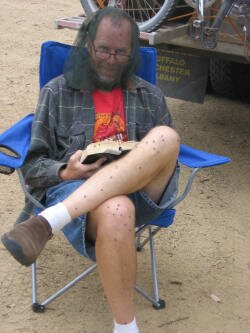
There were several free, organized campsites along the road, some closer to the Snowy River and some on side rivers. We chose the site at Jacobs River, and despite the fact that it was a Friday night, we had the place all to ourselves. While enjoying the remainder of the day, we sat outside wearing our usual fly nets as protection from the tons of flies.
|

Snowy River
|
See all of the flies!!
|
Nov 3-4
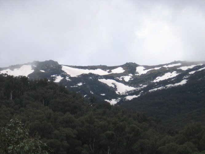
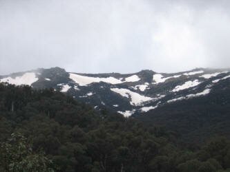
| The next couple of days were spent enjoying the beauty of the National Park. The weather didn't really want to cooperate however and the view that we were hoping to see of the tallest peak in Australia, Mt. Kosciuszko at 2,228m (7,300ft) was completely obscured, but the park had a different kind of beauty in that weather. |
|
We spent a night at another campground right on the river with a huge meadow right behind it. The meadow was full of kangaroos and more seemed to materialize out of nowhere. The scenery was so beautiful that we didn't want to miss it, so when it started raining, we pulled out our "sun" shade and used it to shelter against the rain which fortunately, was falling straight down.
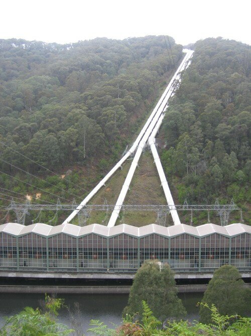
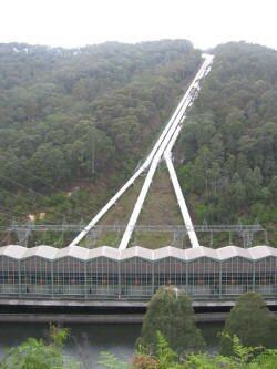
We also visited the Murray 1 Power Station which is the first station in line for the Snowy Mountains Hydro Electric Scheme.
| The Snowy Mountains Scheme is a hydro-electricity and irrigation complex. The waters of the Snowy River and its tributary, the Eucumbene, are captured at high elevations and diverted inland to the Murray River and the Murrumbidgee River, through two tunnel systems driven through the Snowy Mountains. The water falls 800 meters and travels through large hydro-electric power stations which generate peak-load power for the Australian Capital Territory, New South Wales and Victoria. The Scheme was completed by 1974, after twenty-five years of construction, and is the largest engineering project undertaken in Australia. The Scheme's construction is seen by many as a defining point in Australia's history, and an important symbol of Australia's identity as an independent, multicultural and resourceful country. Source: Wikipedia |
|
Our visit to the power station was very interesting and the displays nicely done to emphasize the difficulty of the task and the effort that people from so different cultures put forth to make it happen.
Nov 5
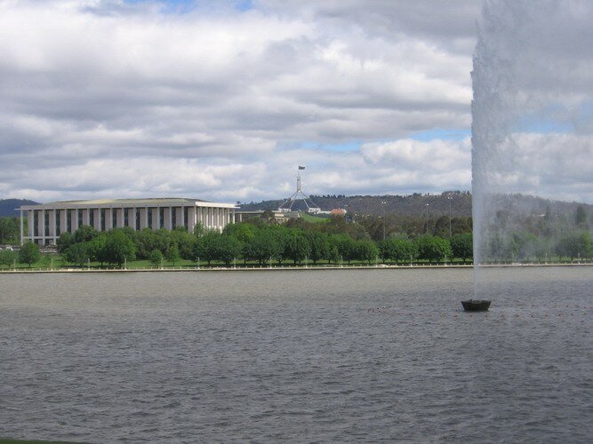
After a windy and cold night, we finally headed off down the mountains and out of the park. The temperature got only slightly warmer as the wind continued to blow. By early afternoon we had reached the Australian Capital Territory, the name given to the region that contains Canberra, the capital of Australia. We drove around Capital Hill, looking over the new buildings that were constructed in 1988 to house the Parliament. We then drove down the hill to the Old Parliament Building (which in our opinion is much more attractive) and then around the city looking at the sights. One of those sights commemorates Captain Cook's travels around the world and is a stream of water that shoots straight up into the air for 147 meters.
|
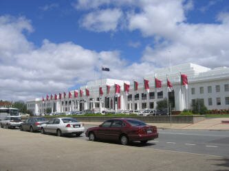
Old Parliament Building
|
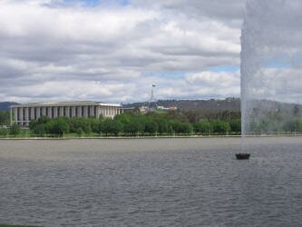
Cap't Cook fountain
|
We then continued on to the Australian Mint and looked at displays about the history of money in Australia.
After leaving the Mint we drove north out of town along the highway towards Sydney. We found a really nice rest area off of the highway with a wall of trees to cut the road noise. This would make great camp spot, but first there was a sign for a winery with free tasting just up the road. At the winery, we had a long talk with the tasting employee about water rights and land values in the area.
|