|
July 9 - 17, 2007
July 9, 2007 We spent the morning talking to the ferry captains and the 4wd bus operators to get some advice about driving on Fraser Island. After our experiences with sand the last couple of days, we were a little leery of putting ourselves into a tough situation. We were told that our dual rear tires present more difficulties in sand than if we had single tires, but the drivers thought that with sufficient airing down of our tires, we should be OK. After talking to these experts, we felt more confident about our chances of making it across the island without too many problems, so we spent the afternoon getting ready and picking up the permits that we need to access the island. We climbed our first sandblow above Rainbow Beach.
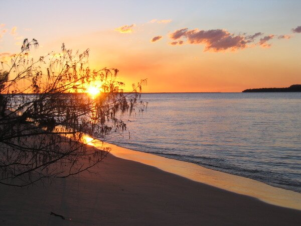
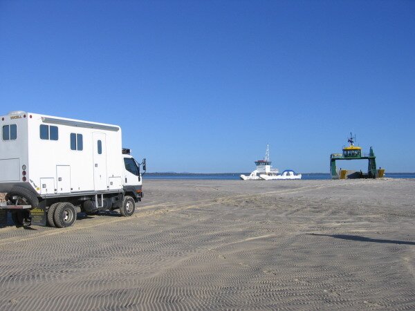
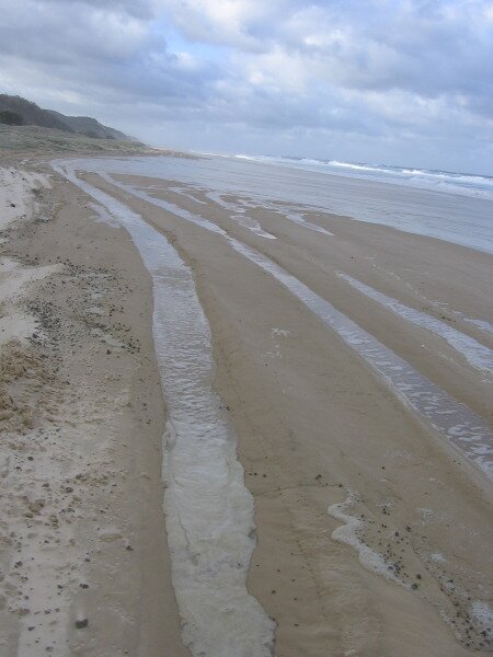
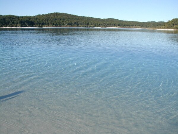
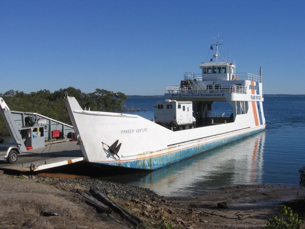
July 10, 2007 Wanting to take advantage of the early low tide, we were once again, up with the sun. At about 7:30am, we drove to the ferry landing at Inskip Point for the 15-minute ride across the channel to Hook Point and started letting air out of our tires. This is necessary to increase the "footprint" the tire has in the sand. The more tire surface that has contact, the more "pull" the tires have to move the vehicle through soft sand. We found out quickly that we hadn’t let quite enough air out when we got stuck in the soft sand on the last stretch to the ferry. So we let out some more air, got out our MaxTrax once again and made it onto the ferry. We also made it off of the ferry onto the hard packed sand on Fraser Island. So far so good.
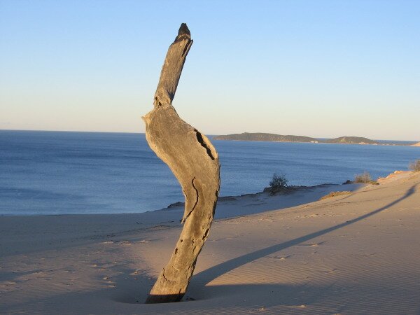
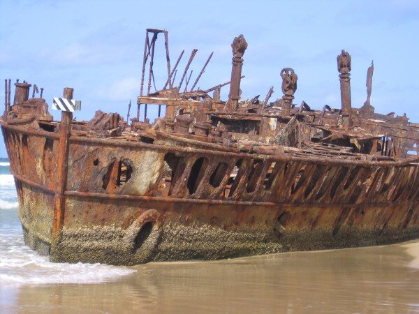
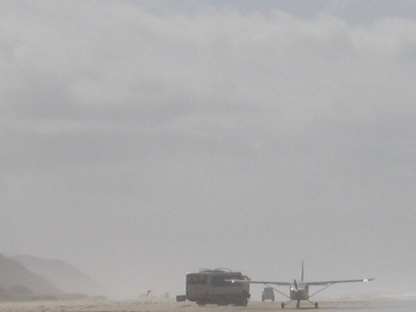
We continued down Seventy-five mile beach, actually only 58 miles long (?), stopping at various sites along the way. Our aired-down tires seemed to be working fine through the softer spots we hit, but we tried hard to avoid any of the really difficult stuff just to be safe. The toughest part was at the wreck of the Maheno. This was a cruise ship that was being towed to Japan to be retired as scrap, when it broke loose in a storm and ran aground. A lot of sand has built up on the shore behind the wreck and 4wd vehicles and tour buses drive through it all day long. The sand was really chewed up and we stopped and considered our options before taking action. Strange, but it made us feel a bit better that even the big tour buses were having difficulty making it through the softer sand. We parked and walked around the ship, and when we returned to the Fuso, we saw that a nice track had been grooved through the sand. We took advantage of it and with lots of forward momentum, breezed through the soft sand. Just past the Maheno, we got to see an airplane land on the beach. There are several areas that are designated landing zones and drivers need to keep their eyes to the skies to make sure no planes are landing. It seemed like a pretty scary task, as there are cars and busses tearing up and down the beach constantly. I wouldn’t want to be the pilot!
Because the low tide was at 10:00am and the recommended driving time is 2 hours either side of low tide, we stopped at noon and found a great camp spot that sheltered us from the strong wind that had been blowing all morning. We did some hiking but mostly we just enjoyed watching the other vehicles disregard the two hour recommendation and drive along the beach, moving higher and higher up as the water came closer and closer.
July 11, 2007
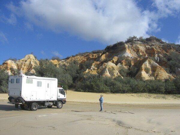
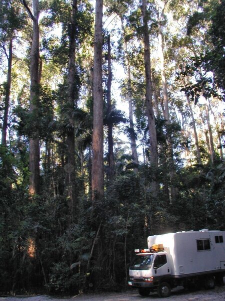
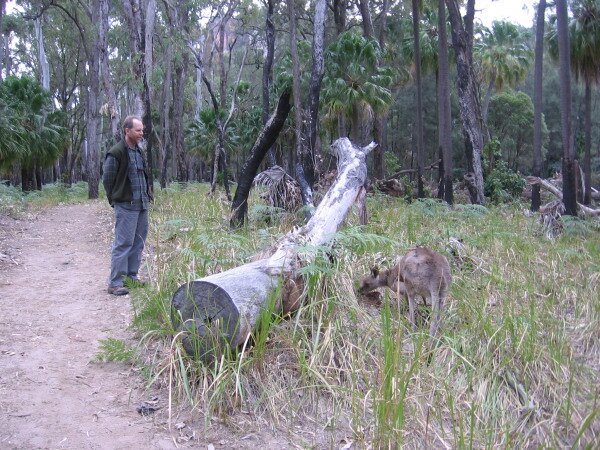
We once again searched the horizon for whales in vain, but did get to see a manta ray in the shallows near shore. On our drive back down along the beach, we suddenly heard a terrible noise and began worrying that our Fuso was in dire straits. Nothing so mundane we found out, as an Australian Air Force jet rattled us as he flew by not more than 50 feet above the beach! We stopped to explore a couple of the more prominently colored sand formations along the beach, The Pinnacles and Red Canyon. The Butchulla people have a story that describes how the colors came to be here. A maiden was in love with the rainbow. One day a warrior saw her alone and tried to kidnap her. As her screams brought the rainbow to her rescue the warrior threw his boomerang. The rainbow jumped in front of the boomerang to save her, but the impact shattered the rainbow and the colors fell to the earth. This was how the colors came to be in the cliffs. We drove on until the incoming tide had covered about half of the drivable beach and then found another great camp spot just behind the dunes. Again we took our chairs down to the beach to watch more crazy drivers literally race against the tide. It was a beautiful day. July 12, 2007 Today we explored the inland part of the island. Our first stop was for a hike to Lake Wabby, a small lake that is slowly being engulfed by a sandblow. Leaving the beach, the soft sand turned out not to even be an issue. The inland tracks that we had been warned about were all very sandy and in some places so deep that our "high" clearance was barely enough to get us through, but get through we did. The tracks are very narrow, and in more than a few places the tree branches brushed along the sides of the camper.
After driving some more rough, sandy and narrow roads we made it to the Central Station campground as night fell. This way we will be less than an hour’s drive to where we will catch the barge back to the mainland in the morning. July 13, 2007
Our errands included finding a grocery store, getting diesel and finding a propane gas provider to change our tank valve and fill us up. The grocery stores in Australia work in conjunction with fuel stations so that if we buy $30.00 worth of food we can get 4 cents a liter off our fuel. Well, every savings helps! Finding a propane tank service center was a bit more difficult. We ended up at a gas filler who provided us with their contact at the local gas company. The manager at Origin Gas was nice enough to offer to help us even though the company generally did not work directly with the public. We thanked him and he even filled our tank for us. Now that we have the proper gas valve on our tank, we will be able to fill it just about anywhere. After spending a good part of the day doing our chores, we decided to drive for a couple of hours just to put a few miles/kms behind us. We found a surprise camp spot on a small stream that had a table, trash can, fire pit and wood, so we had a nice campfire to keep us warm. July 14, 2007 We awoke to the sounds of birdsong surrounding us. Despite the fact that there was frost on the grass, we grabbed our binoculars and starting checking out the birds, identifying about a dozen new ones. We also took advantage of the quiet location to prep the Fuso for the dusty roads we expect to encounter. As we drove inland, we read many signs along the highway proudly stating "Queensland: Better Roads For You" despite the fact that we found ourselves tossed about by the rough bouncy roads. July 15, 2007 We’re finding that distances in Australia are going to take us longer than expected to cover. So far we have not been able to reach our destination in a single day of driving. Not that this is bad as we enjoy seeing the sights, it will just take us a bit to get used to. We arrived at Cania Gorge NP in time for a late breakfast, then did a nice hike through one of its sandstone canyons. We are traveling through the Sandstone Belt and there are lots of parks to choose from to explore in the region. Our next camping and hiking destination is Carnarvon NP where we can explore numerous overhangs filled with Aboriginal rock art. Along the way we passed through the town of Gayndah, which bills itself as the oldest town in Queensland. In salute to its citrus history, the town has a giant mandarin orange that you can walk through. Australia has many such "big" things to draw in the tourist. July 16, 2007
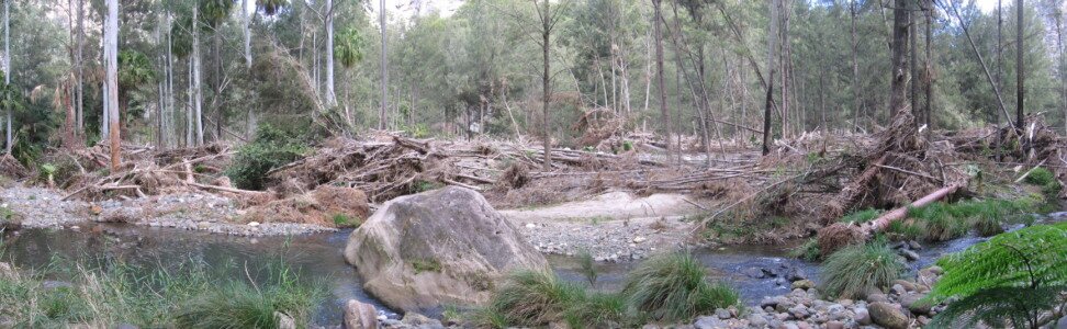
After lunch and a visit to the visitor’s center we hiked along Carnarvon Creek where we witnessed the force of the water that raced through here as a flash flood in February, 2007. There were many, many downed trees and lots of debris. When we asked at the visitor center how high the water came up, she told us it had damaged the visitor center. Our guess is it was 20 feet higher than the level we saw today. We were also very impressed by the amount of cleaning up that had been done by the rangers in the last five months.
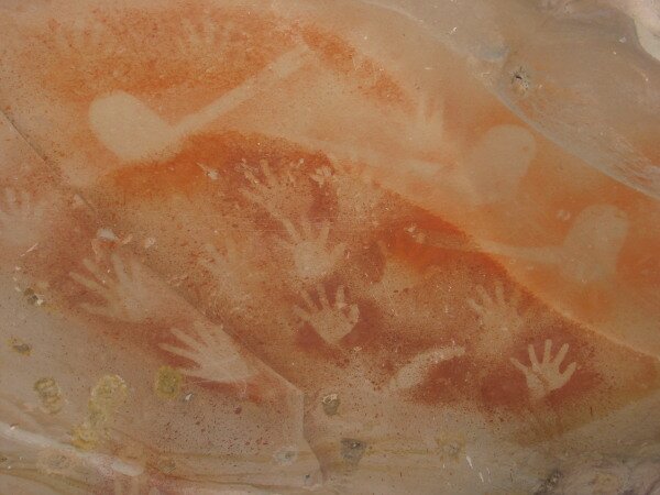
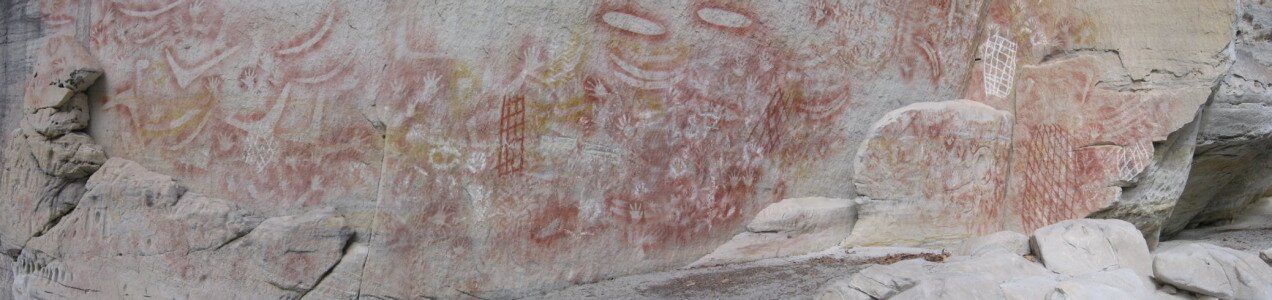
July 17, 2007 We got moving early again this morning so that we could do a hike through the Carnarvon Gorge to The Art Gallery where there are more than 1,000 images created by the Aboriginal people. Many of the images are of hands, there are several of a couple of different types of boomerangs and animal prints and there are many others that can be interpreted in different ways by different people.
The Art Gallery was the highlight of our walk, but the scenery was beautiful and the experience quiet and peaceful. We hiked up a side canyon where we were able to see King Palms that grow nowhere else in Central Queensland. They are remnants of the tropical rainforest that once covered the area.
|