|
July 3 - 8, 2007
July 3, 2007 After saying goodbye to our new friends, the Langes, we drove to our designated caravan repair center as Dometic, our refrigerator sponsor wanted, for the second time, to replace our refrigerator. This time because the fridge had developed a big interior crack and a deformation in the side of the freezer. As nice as it sounds to keep getting new equipment, it is a stressful thing. We are trading-in a known quantity for something similar but not tested. Additionally, it is a big job to remove a cupboard so that we can access the rear of the fridge, unwire it, and then replace this heavy piece of equipment. Well, all went well and we were finished with the job in about two hours. We ran a few more errands, and finally headed north so that after 10 days in the Brisbane area we were officially on our way to explore Australia.
We headed off towards the north as our route is tentatively set to follow the east coast of Queensland all the way to Cape York, then west across the Northern Territory.
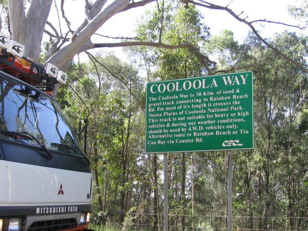
In the morning we drove to the town of Noosa so that we could purchase our camping permits for the Cooloola Section of Great Sandy National Park. The park will provide us a mini preview of what we can expect on Fraser Island. There is a 40km long beach that we can drive on and a river to kayak as well as pockets of rainforest and woodlands to explore. July 5, 2007 Driving back into town to collect a few last supplies, we spied a Laundromat and decided to do a bit of a wash before heading off into the wilderness. We bought a couple of scones (biscuits) at a local bakery, to have with breakfast. After doing our regular chores, filling water and completing our dump, we drove into the park and our destination at Harry’s Hut. This was our first chance to use our friend Brad’s Dirty Weekends 4WD Guide. We followed his detailed route, stopping to explore a few places along the way.
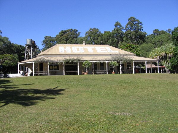
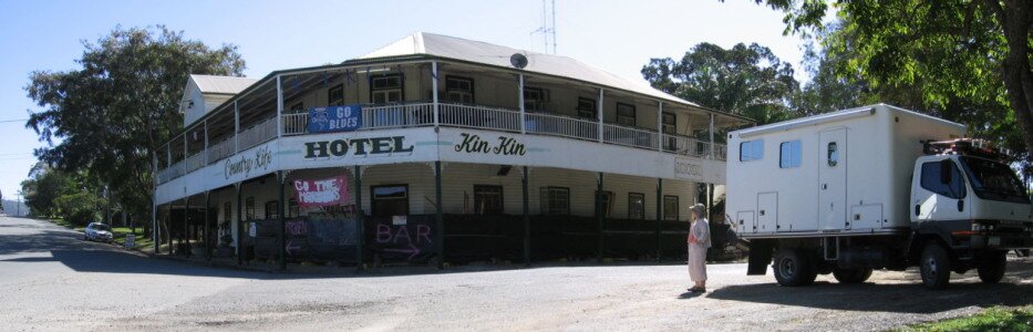
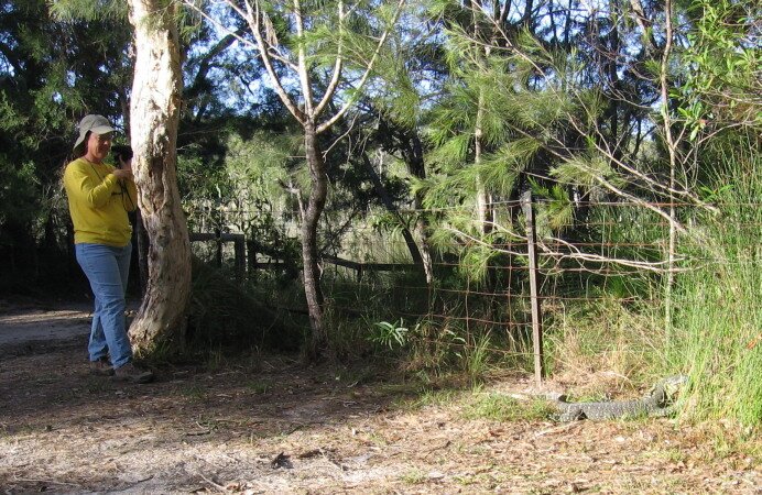
Moving on, we saw our first kangaroos in the grassy field of a large campground. We detoured off to visit our first "classic" bush pub at Kin Kin, but found the pub closed for restoration. We did look at some photos dating back to the pub’s early years (just after it was built in 1914) showing the pioneering days of the district.
The road to Harry’s Hut has a sign at the entrance stating that it isn’t suitable for heavy or high vehicles – hmm. We went anyway, and to our relief found that the sign must be for vehicles heavier and higher than our Fuso. We did cross over two small wooden bridges that looked iffy, but again, no problem.
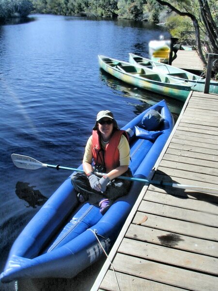
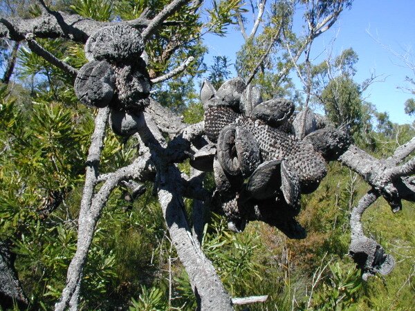
July 6, 2007 The Noosa River drains the region and eventually flows to the ocean. More than one-third of the river’s total catchment area is protected by the national park which adds to the high water quality. What is interesting for us, is that the river flows so slowly that we can kayak upstream all morning and end the day back at our starting camp! Strange, but true. We paddled upstream until lunch, then hiked through a beautiful sandy area full of scribbly gum trees, banksia trees and spinafex grasses. We also found that in Australia clams grow on trees! Not really, but the seedpods of the banksias look just like open clamshells. After lunch we turned around and paddled downstream back to camp.
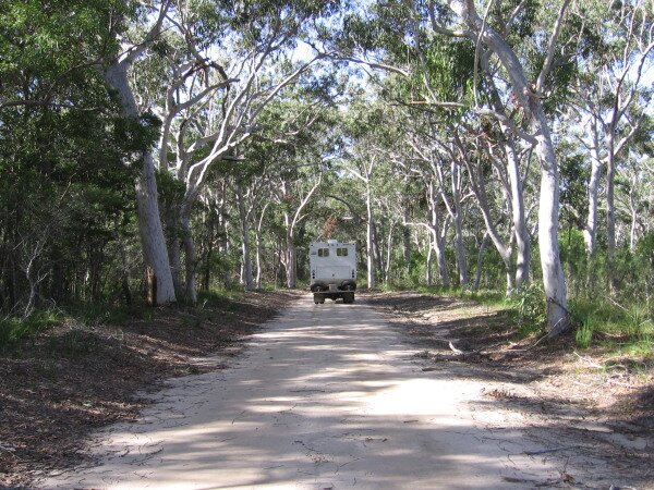
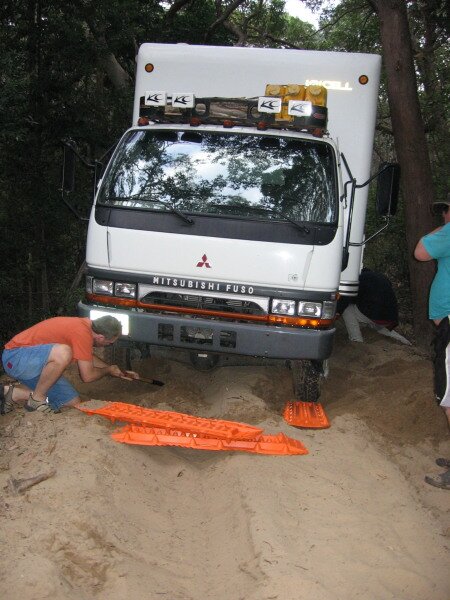
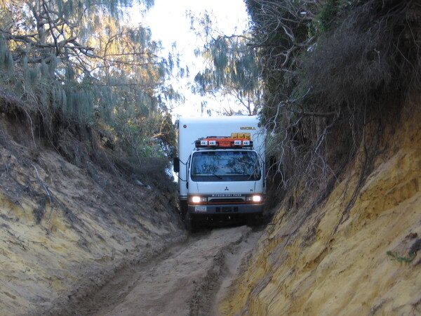
July 7, 2007 We got a late start today after deflating the kayak and packing away all of our equipment. Not being in any hurry, we didn’t mind leaving at 11:00am. We retraced our drive out from camp as the road is a 14km dead end road. Back at the main road, still recommended only for 4wd, we continued on our roundabout way to the beach. We crossed over the Noosa River where it is just a creek, before heading to the beach on an 18km sandy track called Kings Bore Road. The guide published by the National Park Service states that we should allow one hour to drive this route. The track started out very sandy, but was nothing that our trusty Fuso couldn’t tackle. The sand driving made for a Disneyland type autopia driving experience – just stay in the tracks and the vehicle nearly steered itself. The drive was spectacular as we passed through forest with many new types of trees for us: blackbutt, tallowwood, gum trees and banksias. What made the drive difficult was that the track weaved its way through the trees, very close to the trees.
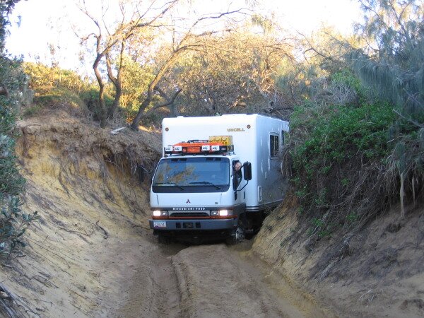
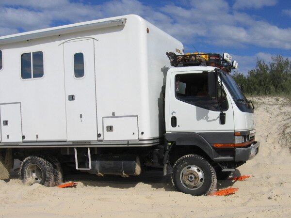
Then before we could find a place to let the cars get around us, we found our way blocked by a tree that was about 10 inches lower than the top of our camper. There was no way to get around it, and we couldn’t turn around to go back. We were so close to the beach that we could even hear the surf crashing. Not knowing what to do, we asked our new friends, who decided that cutting down the tree was the only option. Looking around the track, we could see evidence of other trees and branches having been cut before. We got out our Max Ax and started at the tree. Soon all of the guys were helping out and the tree soon gave way. We pulled the tree out of the road and drove on, still looking for a place to let the other vehicles get by us. Then when we did try to get off of the track, we bogged down so deep that the rear tires where buried to the axle. Again, Maxtrax to the rescue and out we came. Unfortunately, by this time we had been on the road for over three hours and it was now dark. We didn’t want to drive through any more possible problems without being able to see them coming so we found a spot where the guys behind us could get around, said our thanks and goodbyes to all of them, and made camp right there in the middle of the road. After all, who would be coming down this tough track in the dark? Well, at about 11:30pm we were awakened by headlights and found out who: three young people out playing. So we jockeyed the vehicles around and got them by us. July 8, 2007 We got up with the sun and checked out the final track to the beach. It wasn’t going to be easy, so it reinforced our decision not to have moved on the night before. There was a downed tree that had fallen across the track, and the track itself, or rather the chute – well, it was only a couple of inches wider than our camper, set on a very step downward angle to the beach and so deep that it was almost like driving through a tunnel! Then we had to drop off an embankment and drive across a stream to the beach.
So we chopped up the downed tree, moved it out of the way, set the Fuso in 4wd low and let it crawl down the hill. It is still amazing to think that we got down to the beach without hitting anything or doing any damage to the Fuso.
|