|
June 8–11, 2007
Despite our best efforts, departure day is never what we plan it to be. After two months of planning and preparation, we found ourselves with barely enough time to finish those last minute chores (of which there always seems to be twice as many as expected), before our taxi showed up to take us down to meet the airport shuttle. Even the extra ten minutes that we got when the taxi was late was used up. But as transit days go, this turned out to be a pretty smooth day. Our connecting flight to San Francisco left on time, and unbelievably, our Air New Zealand flight actually left about 10 minutes early. After watching a movie and eating a late dinner, we were actually able to get about 8 hours of sleep while en route. Arriving in Auckland, our shuttle driver was waiting for us and drove north to the town of Mangawhai where our hosts and friends, Murray and Shona, were waiting for us after allowing us to park our expedition vehicle on their property for the last 10 weeks.
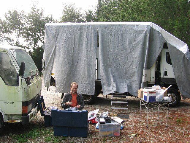
We spent the next two nights with our hosts as we prepared our vehicle for travel. Luckily, the rain stopped for a while the next day which gave us time to unpack our supplies and get our cover dried out so that we could store it away. We even had time to drive into town to pick up a few supplies so that we could return the favor and prepare dinner for our friends. June 12-13, 2007
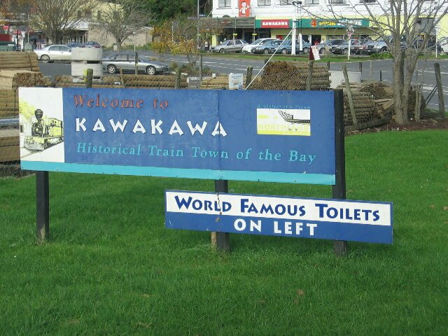
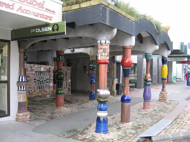
We continued north, stopping in the town of Kawakawa to admire the public toilets. Yes, I said public toilets. The toilet house was designed by renowned artist and adopted son of Kawakawa, Friedrich Hundertwasser and it is quite beautiful and unique. Born in Austria, Hundertwasser came to New Zealand in the early 1970’s and became a citizen in 1986. He died in 2000 and is buried on the farm he owned in Kawakawa. He was commissioned to build the toilet block in 1997, and he encouraged the use of local labor and talent. Tiles used in the project were made by local students, bricks came from local buildings and windows in the block were constructed using old bottles. Trees and plants grow on the roof. All in all, it was a very interesting stop.
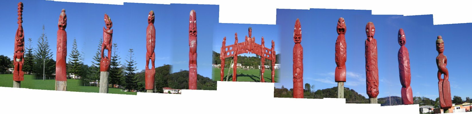
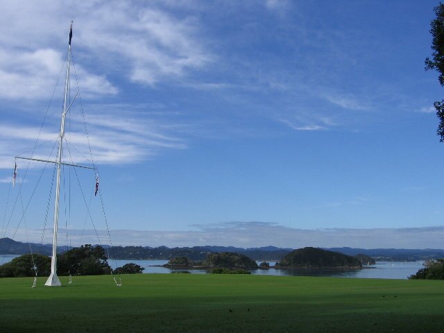
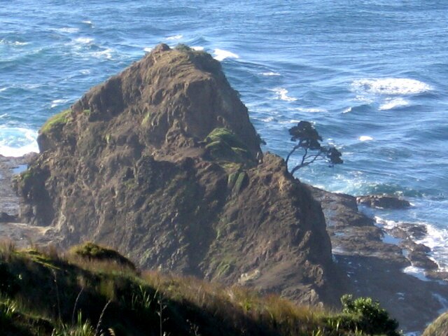
We ended our day in the town of Paihia, where we found a quiet spot to stop, parked on a city street, just up from the water. In the morning we bought coffee and pastries from the local bakery and wandered along the shoreline, admiring the view. The Bay of Islands takes its name from the 150+ islands that dot it and the morning view with the rising sun reflecting off the fog, was spectacular. Just north of Paihia is the Ti Tii Marae. Aside from the beauty of the carved statues adorning the grounds, the Marae has historical significance. This is where Maori chiefs gathered to debate the question of signing the Treaty of Waitangi. Just up the road, across a bridge, is the Waitangi National Reserve where the controversial Treaty itself was signed on February 6, 1840. By the terms of the Treaty, the Maori agreed to put themselves under the protection of the Crown, and the British agreed to honor the rights of the Maori. There are lingering questions as to whether the British have held up their part of the agreement.
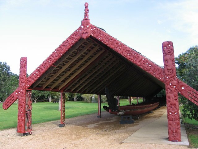
The reserve consists of the Treaty House, a Marae (open to everyone) that was constructed in 1940 for the centenary of the signing and a waka (canoe) also constructed for the centenary. The waka holds over 70 paddlers and can carry 50 additional passengers! The grounds were restored in 1933 and again in 1990. The grounds are beautiful and have a great view looking back towards Paihia overlooking the harbor and several of the rocky islands in the bay. Actually, it was quite spectacular.
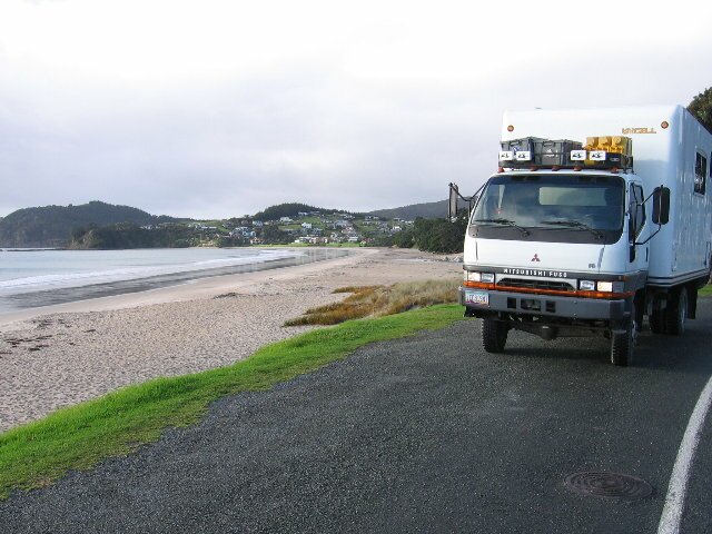
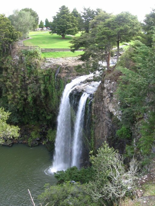
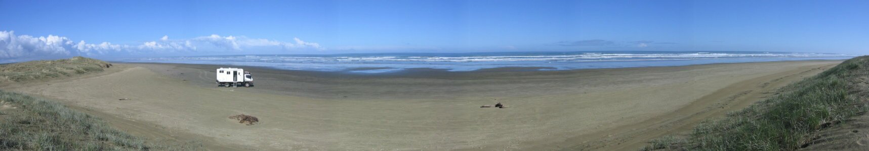
Leaving town, we continued our drive northward, stopping to explore the historical Stone House and Maori Pa (fortified settlement) in Kerikeri. We then hiked to another great waterfall, Rainbow Falls, from where the original land developer built a water-powered electrical generator in the 1930s to provide power to the town. We set up camp in a small turnout along the shore of Whangaroa Harbor, a picturesque spot at the end of the road. We’re trying to get used to the winter weather and the very short days as the sun is setting by 5 pm. A small side note, the wreck of the Greenpeace ship, The Rainbow Warrior, is located offshore near the Cavalli Islands. The ship was sunk in Auckland Harbor by the French, resulting in the death of one Greenpeace volunteer, and the galvanization of the entire country against both the French and nuclear testing. New Zealanders subsequently declared themselves a nuclear-free zone. June 14, 2007 We arose to a completely fogged-in Harbor. We took our morning walk anyway going down to the end of the road and the boat launch. Then we headed off toward the Aupouri Peninsula where we could drive Ninety Mile Beach. Along the way, the sky cleared and the scenery was beautiful. We stopped in the town of Mangonui and got information on the tides. Driving the beach requires that you arrive and depart the beach within 2-1/2 hours either side of hide tide. As luck would have it, our timing was perfect and we were going to arrive at the beach 1-1/2 hours before low tide. That would give us a total of four hours to play. The section of Ninety Mile Beach that people typically drive is actually only about 40 miles long. And the beach itself is really only about 90 kilometers long, but we haven’t been able to determine the origin of the name. We turned off at Waipapakauri Beach and hit the sand. Driving the beach requires some skill and constant attention. There are areas of soft sand and we had been warned to be on the lookout for "sand holes". We did periodically hit areas that were soft but we never hit any holes. There was also the occasional stream flowing out of the hills that we had to cross. We stopped several times to explore and to look at some of the shells and fish that were washed up on the beach.
When we stopped for lunch, we set up our chairs in the sun and enjoyed our solitude on the beach. While we had periodically seen tire tracks, the only time we had seen other cars was right around the beach entry and exit points. We didn’t see anyone else driving on the beach. This was surprising because this is considered one of the main tourist areas. But while we were eating lunch a small plane approached flying low. We waved, hoping to get a "wing waggle" but instead the pilot did a full 360 degree turn over us. Laughing we waved goodbye and went back to enjoying the quiet.
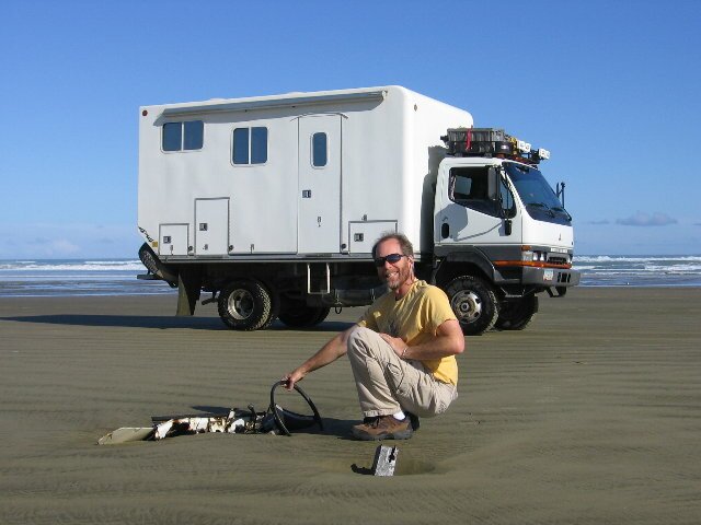
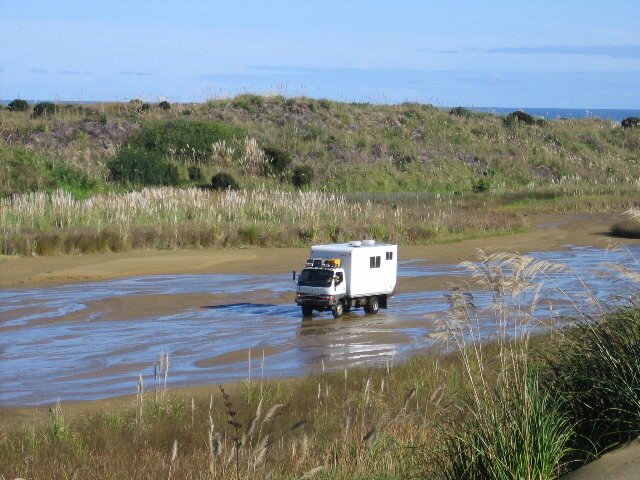
The last part of our adventure involved finding the beach exit point. The other exits had been pretty obvious or had had landmarks to identify them. This exit was unique in that it was actually a stream that you drive through. As it turned out we passed it and had to turn around and go back. Once we were in the stream there was a sign. They couldn’t have put it closer to the entrance?
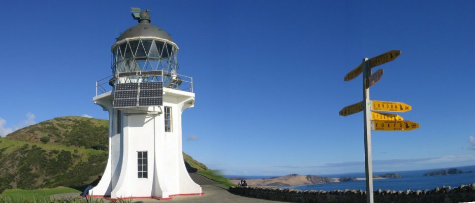
Continuing on, we finally exited the stream and turned north to Cape Reinga. The cape is the most easily accessible northern spot of New Zealand and is at the end of the 116km long peninsula. It is also the spot where the Pacific Ocean meets the Tasman Sea. There is a lighthouse and a beautiful view in all directions.
Three kilometers back down the road, a side road lead to a beautiful campground where we decided to spend an extra day relaxing and to begin getting the truck ready to ship to Australia. |