|
Feb 6 - 13, 2007
After spending the night in the town of National Park, we headed down the road to the town of Wanganui (not to be confused with the Whanganui River, although the river does run through it.) We had hoped to celebrate Waitangi Day (the day the Maori signed a treaty with the British for British rule) with the locals, but there wasn't really much going on. So we decided to celebrate by visiting the local museum which had a marvelous collection of Maori cultural artifacts and also a lot of information about the terrible flood that befell the area in February, 2004. We also stopped to do some grocery shopping where we met some travelers on bicycles whom we helped find a local campground.
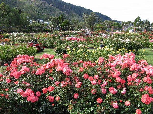
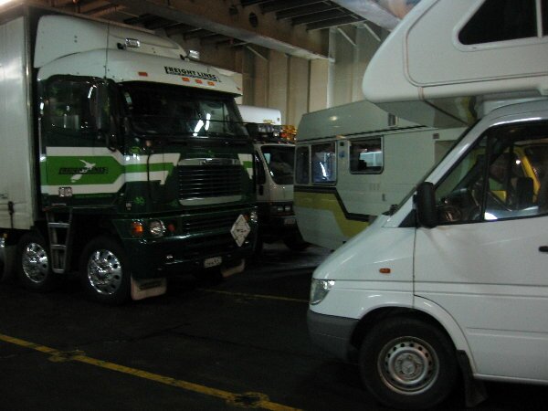
The next day we drove to the capital city of Wellington to confirm our reservation with Bluebridge Ferry for our ride across the Cook Strait to the South Island. Bluebridge is one of our sponsors and they not only gave us a discount on the ferry, they allowed us to spend the night in their parking lot. Before closing up shop for the night however, we did a quick exploration of town by taking the cable car up to the Botanic Garden.
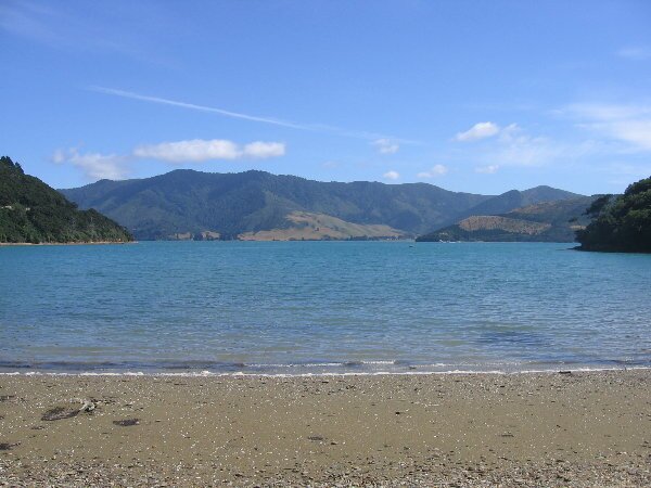
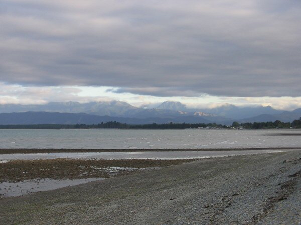
After arriving in the town of Picton on South Island, we made our way to a park overlooking the harbour and made lunch. We then drove along the very winding Queen Charlotte Drive, so that we could follow an even narrower and winding road into the Marlborough Sounds region. The sounds feature many bays, islands, coves and waterways which were formed by the sea flooding deep valleys after the ice ages.
We found a very nice DOC campground called Nikau Bay, with a small group of Kiwi motor-caravaners already ensconced. They welcomed us, however, with open arms into the only space left and were as eager to learn about us as we were to learn about them. We traded stories for a while and then went for a swim in Kenepara Sound. A little while later, we inflated our kayak and paddled around. After we returned, one of our neighbors presented us with a gift of mussels he had collected from the nearby rocks. We prepared them in the Kiwi manner by boiling them in sea water and they tasted wonderful! This area was so beautiful and the company so delightful that we spent a second day just relaxing! And surprisingly the sun shone both days, although the second day was quite a bit windier than the first. Our next destination was the furthest western and northern point on South Island, Farewell Spit. However, we didn't make it there as we spent our time walking around the town of Nelson, running a bunch of errands and enjoying a Thai lunch out. Finally heading out of town we stopped again at our first NZ winery to do a bit of tasting. Tearing ourselves away, we found another nice waterfront camping spot at a "scenic reserve". Scenic reserves abound in NZ, sometimes providing camping grounds, sometimes just parking lots and sometimes just an area to drive through and enjoy. We have already enjoyed quite a few of them.
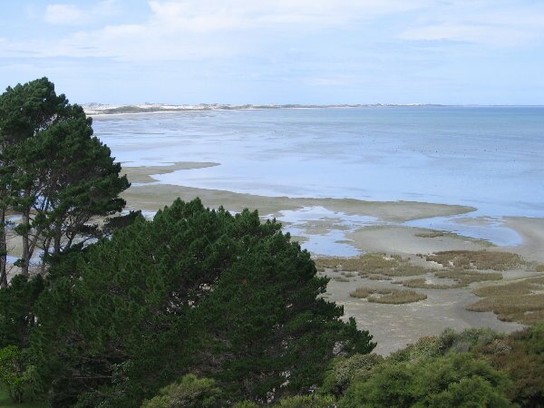
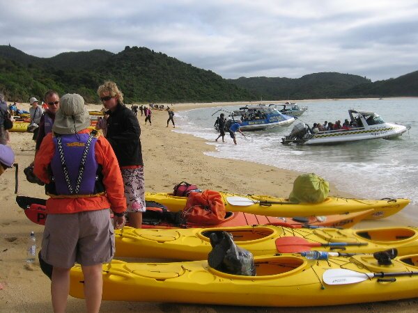
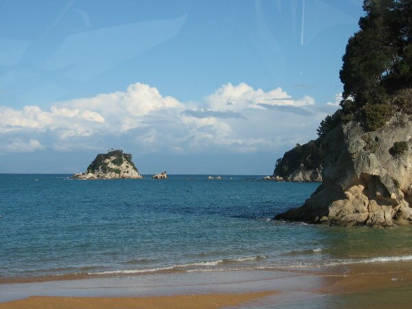
We made camp at our next destination, Marahau, where we made reservations for a day-long ocean kayak trip in the Abel Tasman Nat'l Park to explore some of the many coves and beaches, and maybe see a few sea lions and maybe a whale or two. The park is named after the explorer who discovered NZ. The park is located on the coast and is accessible only on foot or by sea. There is a multiple day tramp (hike as non-Kiwis call it) that stretches 51 km from end to end. Our preference was to explore the park by sea kayak. The set up is rather interesting by itself. Our kayaks were loaded onto the back of a water taxi that took us nearly two-thirds of the way across the park. We were dropped off at Onetahuti Beach with our kayaks and from there we paddled back along the coast for about 15 km to Anchorage Bay where the water taxi met us and took us back to town and our truck.
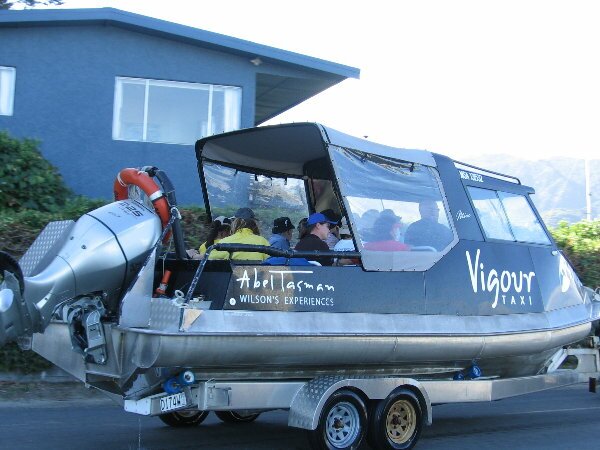
We chose this route so that we would have the wind at our backs rather than blowing water off the swells into our faces. The brochures and the photos we had reviewed online showed beautiful sandy bays and calm, flat turquoise water all along the coast. Oh yes, and beautiful cloudless, sunny skies. After several days of cloudy, worrisome sky we did actually get to see the sun by lunch time. As its impossible to guarantee the weather, you go and explore when you have the opportunity regardless of the weather - so here we got lucky. The calm water was a different story. But since we had the wind at our backs, the kayaking was spectacular. We passed along long sandy bays with romantic names like Mosquito Bay and Sandfly Bay, and we got out on land long enough to enjoy a walk after lunch at Bark Bay where our guide cooked up some fresh mussels that he picked off the rocks in the bay. Returning to town after our day on the water, we enjoyed an unusual journey on the water taxi. The waters around this region experience a huge tidal range. It is typical for the tide to rise and fall by as much as 10 feet. So when our water taxi arrived back, we were met by a tractor pulling a boat trailer. The taxi drove right up onto the trailer, then the tractor pulled us out of the water and down the road into town - while we were still sitting in the back of the boat! Talk about door to door service.
|