Welcome to the sixth phase of the Around-the-World driving expedition of the World of Wonders Project. Kim & Don welcome you back as we complete our exploration of South America driving northward along the Andes through Peru, Ecuador and Colombia.
Ahh, arrival back home in our Fuso Expedition Vehicle. As exciting as international air travel sounds, after flying back and forth several times a year, it feels more like traveling across a big city at rush hour. What's more, travel out of the United States, maybe because of all of the security measures just gets more trying. Getting through the airports is actually very easy. The workers are helpful, and the travelers are generally more patient. So where is the problem? The airlines themselves. This is the second time in a row that the airlines have messed us up on our return to South America.
Although this journey was made directly and we arrived at our scheduled time, we arrived minus two of our four bags. Kim arrived sans all of her clothing and toiletries, and we arrived minus one of our bags of Fuso parts and supplies. Fortunately, the airline people in Lima were able to check their computers - everything is on computers now - and found that our bags somehow failed to find their way onto our flight in Houston. They told us the bags would arrive on the next flight, 24 hours later. When we explained that we would be 200 miles (322 km) away in another city, they said "No problem, we'll ship them to you". And sure enough, about 40 hours later we got our bags in Pisco, Peru.
But back to Pisco. We had left our Fuso in the parking lot of a hotel and when we arrived back, our vehicle was still tucked away in the lot, nice and secure - if not a bit dusty. We put away its cover and reconnected the batteries and just like magic, we had full power, all circuits go! Since we didn't have any food on board, we went out to dinner and celebrated with Peru's National Drink - Pisco Sours. The next day we verified that our bags would be joining us for this expedition, then went about getting ourselves ready. First to a couple of mechanics for needed Fuso service, front end alignment and general tightening, oil and fuel filter changes, then food shopping to fill up our pantry.
Then to the markets in town to stock up on supplies. By markets I don't mean the full service, large American style supermarkets. We were able to find one small market where we picked up dry goods, some boxed milk, yogurt, etc. Then we located the main outdoor market where we could buy our veggies and meat. Yes, we buy our food in the same places that the locals do. In this case we were treated to a new experience - the butchers from whom we got our lamb and pork, chopped our "steaks" using an axe! Even so, the chops were good looking.
As the afternoon got late, a bus arrived presenting us with our missing bags, so we headed down the road to the beach at Paracas to spend the night. Driving around the area, we decided that the sand on the beach looked too soft to drive on. So we kept looking and found a yacht club right on the beach that when we asked about spending the night, the guard didn't even hesitate with his approval. He even let us camp right next to their pier. It was a beautiful and peaceful place.
Sunday morning we got up fairly early as we had decided to try to make it across Lima on a "slow" business day. Lima has over 8 million residents and tons of taxis and buses. We hoped to follow the Panamerican Highway right through the city. We had heard, oh it's easy, just follow the signs. That's great if you can find the signs. Actually we did really well. We only missed one sign, which sent us on a tour of Lima, finding our way back to the Panamerican just before we would have had to negotiate downtown. But the traffic was light and our drive was really interesting.
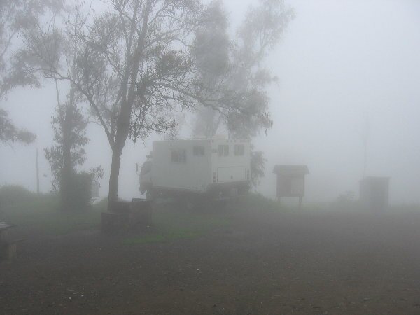
We drove northward for another hour or so and set up camp at La Reserva Nacional de Lachay. After driving for hours through the sandy coastal desert, the Reserve is truly a breath of fresh air. The Reserve is located in one of the last remaining Pacific Coastal Fog Forests. The fog nurtures the plants with its moisture, providing habitat for more than 180 species of plants and an additional 60 species of birds. Sure the fog makes it a bit difficult to see the birds, but at sunset they put on a virtual concert of songs.
September 18 - 20
Waking up to a "white out" caused by the fog, we drove down the mountain toward the coast. As we went the fog lightened up and we were treated to vistas of yellow flowers carpeting the ground.
|
|
|

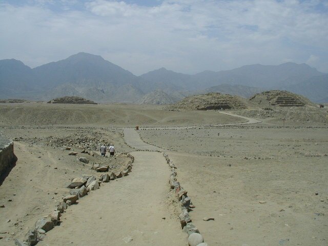
Back on the main road, we headed toward our destination of Caral, the oldest city in the Americas. Our guide books made the directions sound very easy. Just turn off the highway 3 kilometers north of Huacho and drive 24 kms to the ruins. We've become very adept at asking for directions, thus saving us from driving too far out of the way. After passing the suggested number of kms, we didn't find a road or even a sign. So we stopped and asked for directions. Nope we had gone too far, go back to the spot with the taxis. OK, we turn and go back, but don't see any taxis. We stop again, and yes it's back the other way again, to the first turn off. At the ONLY turn off, we ask again, yes this is the road, yea!
HA! We followed a twisting, turning dirt path through the sugarcane fields. Asked for directions a couple more times and we were set. Then things get interesting. We pulled up to a gate with a guard who tells us that we have to get our Fuso washed off and disinfected as the road goes through a private chicken ranch and they didn't want us to infect their birds.
| So after a drive of 25 km (15 mi in 1 1/2 hours (math test time - 10 mph/16 kmp) we arrived at the ruins. The ruins are situated between a river valley and sand dunes. Caral dates back to 3000bc, and it is not the only city in the valley. There are at least eight other sites from the same time period, but Caral is the largest. The pyramids are still being excavated and also stabilized for their tourist value. We were limited in where we could explore, but the site is huge and had a couple of round sunken plazas that are unlike any other we have seen before, and are very interesting. |
|
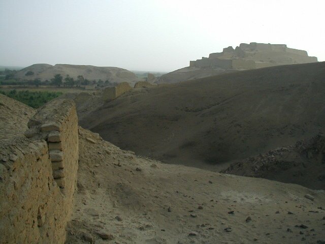
After leaving Caral and taking a different winding path back to the highway (same travel time though) we resumed our drive north. We hoped to camp for the night at the ruins of a Chavin era ruin just off the road to Huaraz, our destination high in the Cordillera Blanca. When we arrived at the ruins we couldn't find a secure parking area to camp in, but we did find a road that goes around back that is perfect for the night. We made our camp at the base of the adobe walls of the Fortaleza Paramonga. Before the sun set we explored some of the adjacent ruins where we found pieces of pottery and shells scattered on the ground among worn and broken adobe bricks from the walls of the ruins.
|
|
In the morning we got our chance to climb into the fortress ruins. The ruins are strategically built on a hill with views up and down the coast. The retaining walls are easily 6 feet (2 meters) wide, and the adobe bricks are in amazingly good shape considering that they are two thousand years old. We let our imaginations run wild and tried to picture this fort in its heyday when it was full of people and the walls were painted a bright red. It must have been very impressive. |
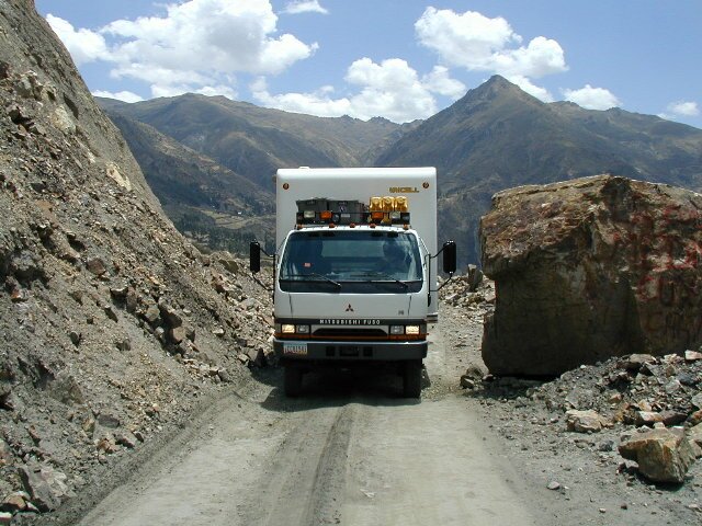
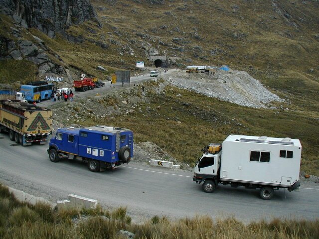
The road that we take up to the Huaraz area climbed very fast. We pulled out our GPS and were surprised that in less than 80 miles we have climbed up to nearly 13,500 feet. Wow, no wonder we are feeling a little light headed!
We decided to continue our way to the main ruins of the Chavin culture at, Chavin de Huantar. This drive takes us up over a second mountain range, the Cordillera Blanca. This range contains the highest mountains in Peru, and the first snow clad mountain we see is marked on our map at over 18,000 ft high (5500 mts). To get to the ruins we have to drive up a mountain pass and cross under it via a tunnel at nearly 14,800 ft (4550 mts). The tunnel is under construction to widen it, so we have a short wait while construction continues. While we wait, it starts to snow! We also met a couple from Austria who are traveling in their converted Mercedes camper truck. We decided to visit the ruins together and find a camp spot. After we cross through the tunnel, we drive down the other side of the mountains negotiating steep switchbacks, rock slides and pouring rain. Along the way we spot miners working at small dark openings - mining coal to be loaded up on passing trucks. We find it hard to believe that these miners work with absolutely no safety equipment, not even a mask or gloves.
|
|
|
A short distance before the ruins, we find a large graveled area, just above a river that makes for an excellent camp spot.
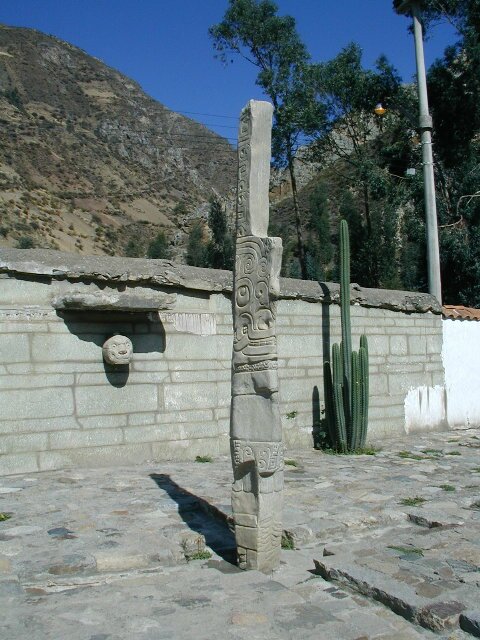
The Chavin culture is the oldest major culture in Peru, existing from about 1000 to 300bc, predating the Inca by 2000 years. The most important deity in the Chavin culture was the jaguar and to a lesser extent, the condor, the snake and human. These are all represented at Chavin de Huantar in very stylized carvings. The Chavin culture also had agricultural knowledge so they had better food and more time to spend on religion and leisure.
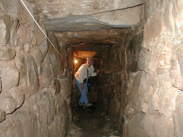
The site contains a large central square, off of which are several tunnels. The main building, the Castillo, once had large carved heads adorning the outside walls, but all but one of them has been moved to museums. The main feature of the site are the tunnels. These tunnels are a marvel of 3000 year old engineering. In the center of the underground complex there is a beautifully carved stellae known as the Lanzon de Chavin. The tunnels were interesting to wander around in. One set of which drain the entire site of water down to the river. A guide took us into these to show us the construction, we had to duck our heads and watch out for bats. There are other tunnels inside each of the pyramids which lead to groups of rooms.
|
|
|
After wandering around the complex, we returned to the Fuso and continued back out of the beautiful canyon where Chavin is located, making it back to the tunnel 5 minutes before it closed for another couple of hours. We finished our day in the town of Huaraz where we have several errands to run.