|
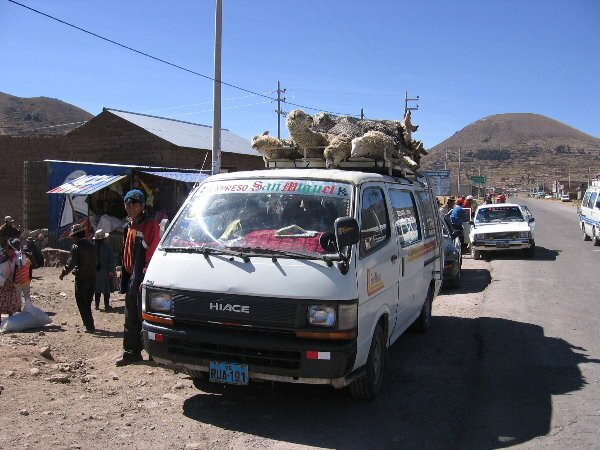
June 6-11, 2006 - Across the Andes to the Pacific We got up early this morning and caught a boat to Isla del Sol (Island of the Sun). This is the legendary birthplace of Manco Capac, the first Inca, and the sun itself. We enjoyed the ride across Lake Titicaca to the island and spent a couple of hours exploring a stone staircase built by the Inca along a natural spring and a building thought to be a small palace built by an Inca emperor along with the fantastic views from both. After returning to Copacabana, we once again enjoyed a trout lunch and went to explore the town. We visited the large cathedral that dominates the center of town and admired the Virgin carved by the grandson of an Inca emperor. After our exploration of the town, we relaxed by watching people in paddle boats float by and enjoying the sunset. After another restful night along the lake shore, it was off to the border with Peru. After hearing some nightmare stories about the difficulties crossing the Peruvian border with a vehicle, we made the obligatory visits to immigration to get our passports stamped, customs for our car permit, the police (we don't really know what for other than to ask for a $5.00 fee (bribe), which we refused to pay) and SENASA who are the people who check to make sure you are bringing any meat, cheese, fruit or vegetables into the country. It all took less than an hour and wasn't any more of a hassle than any other border. As soon as we finished up at the border, we headed up the west side of Lake Titicaca. We soon encountered obstacles in the road in the form of rocks. We aren't sure why they were placed there, but Peru just completed a volatile election and the rocks may have been a form of protest or a way to block the road during the election (to make it more difficult for people to vote.) From the shear quantity of rock, we presumed that they were recently placed. Anyway, we avoided them and continued down the road to the town of Puno. Speaking of the election, we have noticed that in many countries around the world, election posters and propaganda fill every inch of bare space including the sides of businesses, homes and rocks. In other countries in the world, there are laws governing campaigning and there are limits on the placement of signs and posters. Never would painting on the boulders on the side of the road be allowed. That would be considered graffiti and would be illegal. But in Peru, every square inch of space has been covered by pleas for votes. These signs and paint will never be removed and will remain until the next election when they will be covered by the next candidate's name.
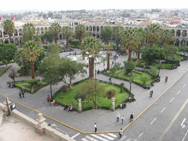
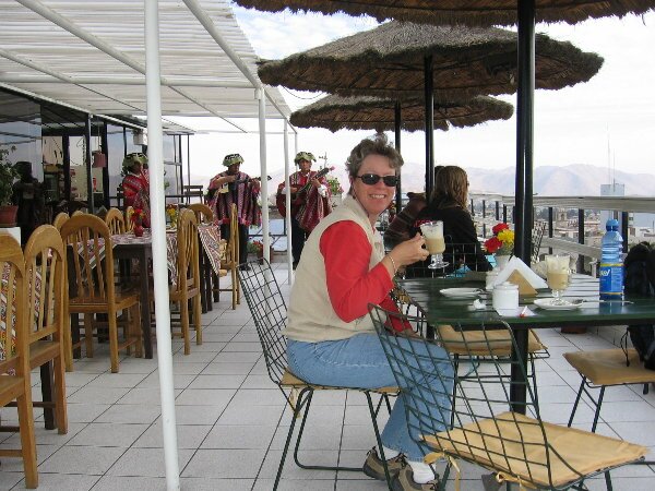
Arriving in Puno, we parked the Fuso and took a bicycle taxi into the center of town. This turned out to be an easy, economical and interesting way to reach the center of town. After running our errands, we attempted to find the road out of town toward the town of Arequipa. So far we had noticed that Peru's road signage was pretty lacking, but now it really became a problem. We had three different maps that showed different routes out of Puno and we couldn't find any of them. Stopping to ask for directions, we were directed to a dirt road out of town, no thanks. We continued north looking for our second choice of roads, but never found that road either. Continuing on to the town of Juliaca, we knew for sure that our third choice of a route came thorough town. However, finding the road once again proved to be elusive. Once again we stopped for directions, which were iffy, but we followed them anyway. The road eventually turned in the wrong direction, so again, we stopped for directions. Eventually we made our way out of town, stopping yet again, just to make sure, but we never saw a sign directing us to this major town (and the small towns on the signs, weren't on our map. Aargh.) As it was getting dark, we pulled off on a dirt side road leading to a small town and found a nice level spot to camp. Since it was getting dark, we figured there would be very little traffic on the road. Well, there wasn't a lot of traffic, but there turned out to be quite a bit more than we figured there would be. Including some very large trucks. We figured there must have been a mine or some large business in that small town, because those big trucks continued to drive by up until about midnight. But it beat being right next to the highway. The night also became our last night, after nearly three weeks, of camping at elevations over 12,000 feet (3,700 meters). In the morning we began our descent from the high Andes, eventually dropping about 5,000 feet (1,500 mts), to the city of Arequipa. Along the way we passed through the Reserva Nacional Salinas Y Aguada Blanca which protects many of Peru's vicunas - the camelids that were so plentiful in Bolivia. We also passed many herders with their llamas and alpacas. So we have now seen all four types/members of the South American camelid family: guanacos, llamas, alpacas and vicunas. We also passed within sight of another smoking volcano! This makes the number of active volcanoes that we have seen on the expedition at SEVEN. Six were sending out billowing clouds of steam, and one had burning lava coming out of a vent on its side. We have been really fortunate to see so many active volcanoes. This brings the number of active volcanoes that we have seen in our lifetimes to 14. Wow. Following coordinates that we had been given by other overland travelers, we easily crossed the city of Arequipa and found the Las Mercedes Hostel, one of the few hotels that have a large enough parking area for vehicles such as ours. There were two very large - yes larger than our Fuso - overland touring trucks (essentially buses) and their respective groups of travelers staying in tents on the hotel grounds. Talking to one of the drivers, we were provided with directions to a secure parking area in Lima where we might be able to leave our vehicle until our final South American expedition in September. After checking in, we headed off to the town center, only about 5 blocks, in search of a cevicheria where we could have a typical Peruvian lunch of ceviche - marinated fish and seafood. Being in the city is comfortable as we had visited here during our Peru Expedition in June 2000. We took a break from wandering around to have a couple of coffees in a rooftop restaurant overlooking the main square: the Plaza de Armas.
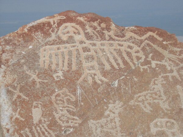
As we continued our drive down to the Peruvian coast, we made a detour to the Petroglifos de Toro Muerto. We have never seen a petroglyph site quite like this one anywhere else. The glyphs are carved onto volcanic white boulders spread over an area of about 2 square kilometers. When we arrived at the site headquarters, we were told of the suggested route to explore the boulders and which number boulders were the recommended ones to try and find to view. Well, we thought there would just be a handful of boulders, but when we started to explore, we found there where well over 1,300 different boulders with carvings of "dancers", animals and geometric patterns. And to top it off, more than just a few of the boulders contained nearly a hundred carvings on individual boulders alone! We spent so much time exploring the area that the entire afternoon passed by, so we decided to stay right there and make camp for the night. It was an eerie experience camping out in this lunar-like landscape.
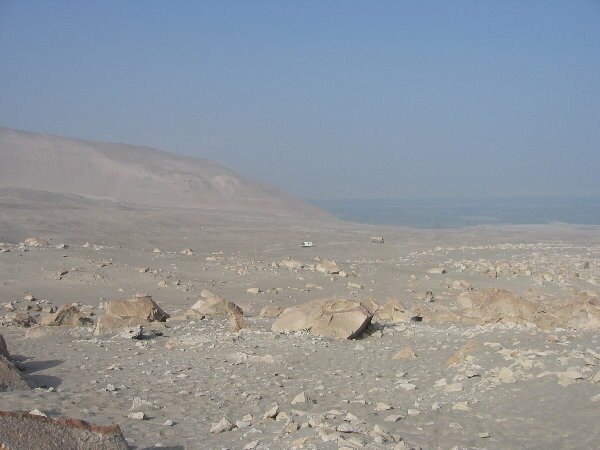
In the morning we headed back out to the Panamericana Highway and drove across the northern part of the Atacama Desert to our destination at the coastal ruins of Puerto Inca. Along the way we passed through the beach community of Camana and were surprised to still see damaged buildings that had been abandoned after being struck by a tsunami in 2001. We also passed through miles of sand dunes and blowing sand, and at one point the road cut across a dune that was so high that we could not see its top through the haze, yet looking off to our left, the dune dropped another 50 feet or more down to the ocean surf. The small ruins at Puerto Inca are of a community that supplied the Inca emperors in Cusco with ocean seafood. Fish and shellfish were harvested from around the area, then dried and carried over the mountains to Cusco. Legend has it that runners would carry fresh fish to Cusco, but this was unlikely. We explored the ruins in the morning and found that in addition to the housing, the entire area had underground rooms built and sealed off. We couldn't find any explanation for these rooms but we thought that they were likely tombs as they were small and completely buried, that is buried until they were dug up by tomb raiders.
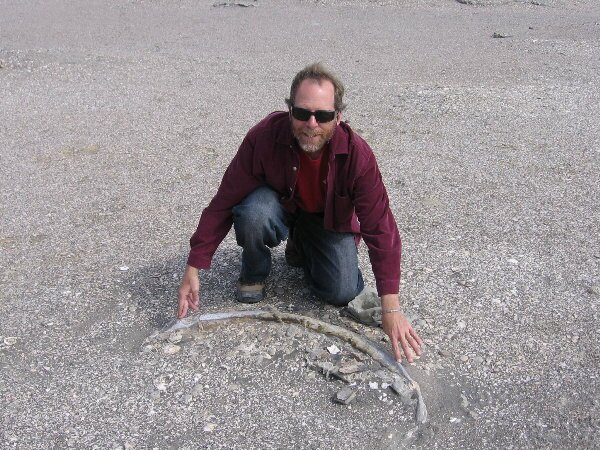
Heading north towards Nazca (the Nazca Lines!) we stopped off to visit a museum in the desert oasis at Sacaco. Here, we had read, the museum contains a fossilized whale found right there in the middle of the desert. Well, when we arrived, the museum was closed but we decided to stick around and have lunch. Pulling off the dirt track, we found that the ground was covered, not by sand but with fossilized shells.
|